
🌍 Geography भूगोल
1178 exam-ready facts · 1109 MCQs
-
581
Physiological density is calculated by dividing the total population by the net cultivated area.
It gives a better measure of population pressure on agricultural land than arithmetic density.
Asked in SSC CGL 2024
Practice (1)
Q576When the analysis of population density is done by calculating it through net cultivated area, then the measure is termed as:
Show answer
Correct answer: D — Physiological density
Answer: (D)
Physiological density = total population / net cultivated area. (Agricultural density uses only the agricultural population.) -
582
The Bhakra Dam is India's highest concrete gravity dam, built on the Sutlej River.
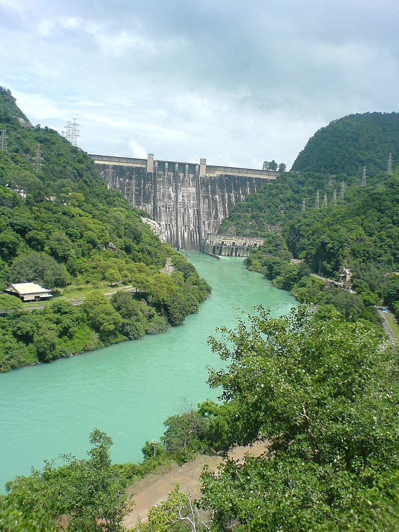
Its reservoir is known as Gobind Sagar Lake.
Asked in SSC CGL 2022
Practice (1)
Q577Which of the following is the highest gravity dam in India?
Show answer
Correct answer: B — Bhakra Dam
Answer: (B)
Bhakra Dam (226 m) is India’s highest concrete gravity dam. -
583
Landslides are defined as the mass movement of rock, debris, or earth down a slope under the influence of gravity.
Heavy rainfall, earthquakes, and deforestation are primary triggers for catastrophic landslides.
Asked in SSC CGL 2017 (21 Aug, Shift 2)
Practice (1)
Q578___________ are defined as the mass movement of rock, debris or earth down a slope.
Show answer
Correct answer: D — Landslide
Answer: (D)
A landslide is the mass movement of rock, debris or earth down a slope. -
584
Vembanad Lake in Kerala is the longest lake in India.
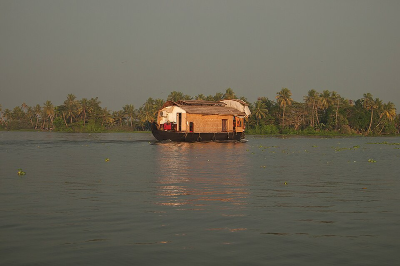
It is famous for the traditional Nehru Trophy Boat Race.
Asked in SSC CGL 2023
Practice (1)
Q579Which of the following is the longest lake in India?
Show answer
Correct answer: D — Vembanad Lake
Answer: (D)Vembanad Lake, situated in Kerala, is the longest lake in India, extending over a length of approximately
. Hence, the correct option is (4).
-
585
Fred Hoyle, along with Thomas Gold and Hermann Bondi, proposed the steady state theory of the universe.
This cosmology model suggests the universe has no beginning or end and maintains a constant density.
Asked in SSC CGL 2023 (21 Jul, Shift 2)
Practice (1)
Q580Which scientist thought of the concept of steady state of the universe?
Show answer
Correct answer: C — Fred Hoyle
Answer: (C)
Fred Hoyle (with Bondi and Gold) proposed the steady state theory. -
586
Oceans hold approximately 97 percent of the total water found on the surface of the Earth.
The remaining 3 percent is mostly locked up in ice caps, glaciers, or freshwater rivers and lakes.
Asked in SSC CGL 2021
Practice (1)
Q581Approximately how much percentage (nearest to integer) of total water on the surface of earth is accounted for by the oceans?
Show answer
Correct answer: B — 97
Answer: (B)
The oceans hold about 97% of the Earth’s water. -
587
According to Census 2011, Himachal Pradesh recorded the highest rural female workforce participation rate in India.
A significant percentage of rural women in the state were actively engaged in economic activities.
Asked in SSC CGL 2024 (9 Sep, Shift 2)
Practice (1)
Q582According to Census of India 2011, in rural India, which state has the maximum female workforce participation rate?
Show answer
Correct answer: D — Himachal Pradesh
Answer: (D)
As per Census 2011, Himachal Pradesh had the highest rural female work participation rate (about 47%). -
588
Tsunamis are catastrophic series of enormous ocean waves typically generated by undersea earthquakes.
They can travel at high speeds across deep ocean basins with devastating coastal impact.
Asked in SSC CGL 2016 (10 Sep, Shift 2)
Practice (1)
Q583"Tsunami" is the name given to which of the following?
Show answer
Correct answer: C — Tidal Waves
Answer: (C)
The correct option is (C). -
589
Keibul Lamjao is the world's only floating national park and is located within the Loktak Lake Ramsar site in Manipur.
It is famous for being the natural habitat of the endangered brow-antlered deer, Sangai.
Asked in SSC CGL 2025
Practice (1)
Q584Consider the following statements regarding India's Ramsar Sites:<br>1. India has the highest number of Ramsar sites in South Asia.<br>2. Keibul Lamjao is the only floating National Park in the world and is also a Ramsar site.<br>3. All Ramsar sites in India are located in coastal regions.
Show answer
Correct answer: A — Only 1 and 2 are correct
Answer: (A)Statement 1 is true. India's list of Ramsar sites is the longest in South Asia.
Statement 2 is true. Keibul Lamjao, on Manipur's Loktak Lake, is the world's only floating national park, and it lies within the Loktak Lake Ramsar site.
Statement 3 is false. Inland sites such as Wular Lake (J&K) and Sambhar Lake (Rajasthan) are far from any coast.
1 and 2 → option (a).
Why the others are wrong(b)Only 2 and 3 are correct: Keeps Statement 3, which is false. India's Ramsar sites include inland wetlands far from any coast, such as Tso Moriri in Ladakh and Keoladeo in Rajasthan.(c)Only 1 and 3 are correct: Keeps false Statement 3 (Wular and Sambhar are inland) and drops Statement 2, though Keibul Lamjao lies within the Loktak Lake Ramsar site.(d)All 1, 2 and 3 are correct: Statement 3 sinks it. Harike Wetland in Punjab and Bhoj Wetland in Madhya Pradesh are inland Ramsar sites, so not all are coastal. -
590
The Accelerated Female Literacy Programme targeted districts with female literacy rates below 30% as per the 2001 Census.
It aimed to bridge educational gaps for women in backward and low-literacy rural districts.
Asked in SSC CGL 2024 (10 Sep, Shift 3)
Practice (1)
Q585The Accelerated Female Literacy Programme was initiated in districts where the female literacy rate, based on the 2001 census, was _______.
Show answer
Correct answer: D — below 30%
Answer: (D)
The Accelerated Female Literacy Programme targeted districts with female literacy below 30% (Census 2001). -
591
Glacial moraines are deposits of rocks, sand, and silt carried and dropped by glaciers.
Moraines can be classified into terminal, lateral, and medial types depending on their location relative to the glacier.
Asked in SSC CGL 2017 (21 Aug, Shift 2)
Practice (1)
Q586The material carried by the glacier such as rocks big and small, sand and silt gets deposited, which are called glacial ________.
Show answer
Correct answer: A — moraines
Answer: (A)
Glacial deposits of rocks, sand and silt are called moraines. -
592
Madagascar is the world's second-largest island country, located in the Indian Ocean off the southeastern coast of Africa.
It is separated from the African mainland by the Mozambique Channel.
Asked in SSC CGL 2021
Practice (1)
Q587Madagascar is located in the ______ Ocean.
Show answer
Correct answer: C — Indian
Answer: (C)
Madagascar lies in the Indian Ocean, off south-east Africa. -
593
Aner, Panzara, and Waghur are important tributaries of the Tapi River.
The Tapi River flows into the Arabian Sea through the Gulf of Khambhat.
Asked in SSC CGL 2023
Practice (1)
Q588Aner, Panzara and Waghur are the tributaries of which river?
Show answer
Correct answer: C — Tapi
Answer: (C)The correct answer is:
Option 3 – Tapi ✅
Aner, Panzara, and Waghur are important tributaries of the Tapi (Tapti) River.
-
594
Nimbostratus and cumulonimbus clouds are specifically recognized worldwide as primary rain-bearing clouds.
Nimbostratus produces continuous steady rain, while cumulonimbus brings thunderstorms.
Asked in SSC CGL 2016 (10 Sep, Shift 2)
Practice (1)
Q589Which of the following is/are 'rain cloud'?<br>1. Cirrus<br>2. Nimbostratus<br>3. Cumulonimbus<br>4. Altocumulus
Show answer
Correct answer: B — 2 and 3 only
Answer: (B)
The correct option is (B). -
595
The crust is the outermost solid shell of a rocky planet, representing the Earth's surface layer.
It is extremely thin compared to the mantle and core, varying beneath oceans and continents.
Asked in SSC CGL 2024 (18 Sep, Shift 1)
Practice (1)
Q590The outermost part of the Earth is known as __________.
Show answer
Correct answer: C — the crust
Answer: (C)
The crust is the outermost layer of the Earth. -
596
Shola ecosystems consist of stunted tropical montane forests in valleys surrounded by extensive grasslands in South India.
They are typically found in high-altitude regions like the Nilgiris and Palani hills.
Asked in SSC CGL 2025 (22 Sep, Shift 1)
Practice (1)
Q591In India, the Shola ecosystem is characterised by:<br>1. Arid and semi-arid climate zones<br>2. Growth of trees in the depressions and folds of valleys surrounded by extensive areas of grasslands<br>3. Dominance of conifers in areas of dense vegetation<br>Which one of the above statements is/are CORRECT?
Show answer
Correct answer: A — 2 only
Answer: (A)A shola is a patch of stunted tropical montane forest in the valleys of South India's high hills, separated from the next patch by rolling grassland. Together they form the shola-grassland mosaic.
That is statement 2 almost word for word. Statements 1 and 3 fail, so 2 only → option (a).
Why the others are wrong(b)1 and 3 only: Both statements it keeps are false. Sholas are wet montane forest, not arid-zone vegetation, and their dominant trees are broadleaved species such as Magnolia nilagirica, not conifers.(c)1 only: Statement 1 is false: Champion and Seth class sholas as Southern Montane Wet Temperate forest, the opposite of an arid or semi-arid zone.(d)All of these: All of these would need statements 1 and 3 too. Sholas are neither arid-zone vegetation nor conifer forest, so only statement 2 survives. -
597
Before being named Mount Everest after British Surveyor General George Everest, the peak was designated as Peak XV.
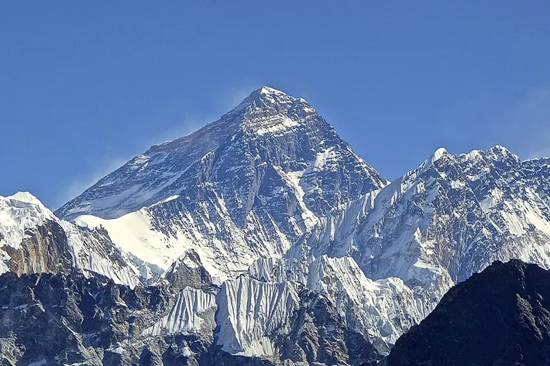
It was labeled Peak XV in 1856 by the Great Trigonometrical Survey of India.
Asked in SSC CGL 2021
Practice (1)
Q592Before being renamed, Mount Everest was simply known as ______.
Show answer
Correct answer: B — Peak XV
Answer: (B)
Mount Everest was earlier called Peak XV. -
598
Five rivers from Punjab (India) enter the river _____ at Mithankot in Pakistan. — Indus
-
599
Pedology is the specialized branch of science devoted to the comprehensive study of soils in their natural environment.
It examines soil genesis, classification, and morphology alongside physical and chemical properties.
Asked in SSC CGL 2016 (10 Sep, Shift 3)
Practice (1)
Q593Science dealing with study of soil is called
Show answer
Correct answer: A — Pedology
Answer: (A)
The correct option is (A). -
600
A seismogram is the visual record produced by a seismograph measuring earthquake waves.
Scientists use seismograms to analyze the magnitude, epicenter, and nature of seismic events.
Asked in SSC CGL 2024 (25 Sep, Shift 1)
Practice (1)
Q594The record obtained by the measurement of earthquake is called a:
Show answer
Correct answer: D — seismogram
Answer: (D)
The record produced by a seismograph is a seismogram.