
🌍 Geography भूगोल
1178 exam-ready facts · 1109 MCQs
-
561
Prayagraj (formerly Allahabad) is situated at the sacred confluence of the Yamuna and Ganga rivers.
This confluence is the site of the famous Kumbh Mela.
Asked in SSC CGL 2022
Practice (1)
Q556______ is a city located on the confluence of river Yamuna and Ganga.
Show answer
Correct answer: A — Allahabad
Answer: (A)
Prayagraj (Allahabad) is at the confluence of the Ganga and the Yamuna. -
562
The Tapi River flows westward through a rift valley towards the Arabian Sea.
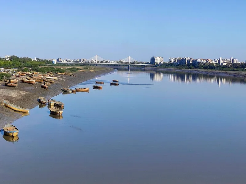
Along with Narmada, it is one of the few rivers that do not form a delta.
Asked in SSC CGL 2022
Practice (1)
Q557Which of the following rivers flow through a rift valley?
Show answer
Correct answer: D — Tapi
Answer: (D)
The Tapi (like the Narmada) flows west through a rift valley. -
563
The mantle is a thick layer of mostly solid rock located between the Earth's crust and core.
The mantle behaves like a very viscous fluid over long periods, allowing tectonic plate movement.
Asked in SSC CGL 2023 (27 Jul, Shift 2)
Practice (1)
Q558The layer of earth that separates the crust from the core is:
Show answer
Correct answer: B — Mantle
Answer: (B)The correct answer is Option 2: Mantle.
Here's a breakdown of why:
Mantle: The mantle is a thick layer of mostly solid rock located between the Earth's crust and core. It's incredibly hot, and over long periods, the mantle behaves like a very viscous fluid, allowing for the movement of tectonic plates.
Stratosphere: This is a layer in the Earth's atmosphere, known for containing the ozone layer.
Magma Layer: While magma is molten rock found within the Earth, it's not a distinct layer. Magma is primarily found in the upper mantle and crust.
Country: This is a political and geographical term, not related to Earth's structure.
In summary, the mantle is the significant layer that separates the Earth's crust (the outer, rocky layer) from the core (the Earth's center composed of iron and nickel).
-
564
Weathering is the breaking up and disintegration of rocks on the Earth's surface by atmospheric agents.
Unlike erosion, weathering is an in-situ process that does not involve the removal of rock debris.
Asked in SSC CGL 2017 (21 Aug, Shift 1)
Practice (1)
Q559___________ is the breaking up of the rocks on the earth's surface.
Show answer
Correct answer: B — Weathering
Answer: (B)
Weathering is the breaking up of rocks at the Earth's surface. -
565
Carbon sink enhancement helps store atmospheric carbon dioxide in vegetation and soil to mitigate climate change.
Forests, soils, and oceans naturally absorb more carbon than they release.
Asked in SSC CGL 2025 (16 Sep, Shift 3)
Practice (1)
Q560Why is 'Carbon Sink Enhancement' important in India’s climate plan?
Show answer
Correct answer: B — Store CO₂ in vegetation and soil
Answer: (B)A carbon sink absorbs more CO₂ than it releases: forests and other vegetation, soils and oceans. Enhancing sinks means adding forest and tree cover and building soil carbon, so CO₂ drawn from the air is stored in vegetation and soil.
India's 2015 NDC set a 2030 goal of an additional carbon sink of 2.5 to 3 billion tonnes of CO₂ equivalent through additional forest and tree cover.
Why the others are wrong(a)Encourage deforestation: Deforestation destroys a sink: clearing and burning trees releases the carbon they stored. Sink enhancement is the reverse, adding forest and tree cover.(c)Burn more fossil fuels: Burning fossil fuels is a carbon source, not a sink. It releases CO₂ locked underground, the very emissions a sink is meant to offset.(d)Promote monocultures: Promoting monocultures is a way of planting, not a purpose. Sink enhancement is defined by its result, carbon stored in vegetation and soil. -
566
The period from 1951 to 1981 in India is widely referred to as the period of population explosion.
During this era, mortality rates declined sharply while birth rates remained consistently high.
Asked in SSC CGL 2023 (24 Jul, Shift 4)
Practice (1)
Q561Which of the following periods is known as the period of population explosion in India?
Show answer
Correct answer: D — 1951 - 1981
Answer: (D)
1951–1981 is called the period of population explosion in India. -
567
Jharkhand is the leading producer of natural lac in India, contributing a major share to the total output.
Lac is a natural resin secreted by tiny scale insects found on specific host trees.
Asked in SSC CGL 2016 (9 Sep, Shift 1)
Practice (1)
Q562The largest producer of Lac in India is
Show answer
Correct answer: B — Jharkhand
Answer: (B)
The correct option is (B). -
568
Colombo serves as the largest city and the commercial capital of Sri Lanka.
Though Sri Jayawardenepura Kotte is the official legislative capital, Colombo remains its economic heart.
Asked in SSC CGL 2020 (3 Mar, Shift 3)
Practice (1)
Q563_______ is the largest city in Sri Lanka.
Show answer
Correct answer: A — Colombo
Answer: (A)
Colombo is Sri Lanka's largest city and commercial capital. -
569
According to Census 2011, Rajasthan recorded the highest gap between male and female literacy rates in India.
This gender disparity highlighted historical lag in female educational opportunities in the state.
Asked in SSC CGL 2023
Practice (1)
Q564According to Census of India 2011, in which of the following states was the gap in the literacy rates of males and females, highest?
Show answer
Correct answer: C — Rajasthan
Answer: (C)
According to the Census of India 2011, the highest gap in literacy rates between males and females was in Rajasthan. This indicates a significant disparity in educational access and achievements between genders. The correct answer is Option 3: Rajasthan. -
570
Lipu Lekh is a high-altitude mountain pass in Uttarakhand used by pilgrims for the Kailash-Mansarovar Yatra.
Lipu Lekh pass is situated near the trijunction of India, China, and Nepal borders.
Asked in SSC CGL 2018
Practice (1)
Q565Name the pass in Uttarakhand which is used by pilgrims to Kailash-Mansarovar Yatra.
Show answer
Correct answer: D — ['4', 'Lipu Lekh']
Answer: (D)
The correct option is (D). -
571
Madhapur in Gujarat is home to one of the prominent large-scale solar power installations in India.
Gujarat has aggressively promoted solar energy parks like the Charanka and Madhapur projects.
Asked in SSC CGL 2016 (9 Sep, Shift 2)
Practice (1)
Q566The largest solar power plant in India is located at
Show answer
Correct answer: C — Madhapur
Answer: (C)
The correct option is (C). -
572
Chilika Lake is a brackish water lagoon situated along the eastern coast in Odisha.
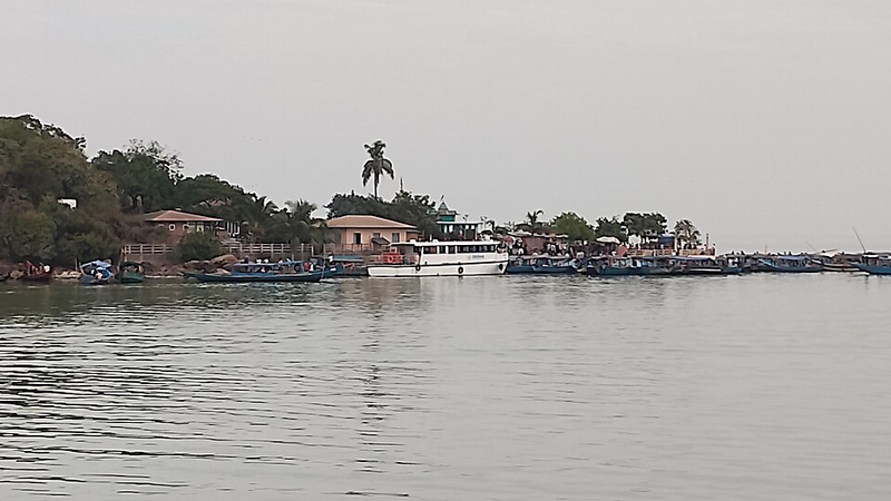
It is the largest coastal lagoon in India and a wintering ground for migratory birds.
Asked in SSC CGL 2022
Practice (1)
Q567Chilika lake is situated in which of the following states?
Show answer
Correct answer: C — Odisha
Answer: (C)
Chilika Lake is in Odisha. -
573
The Earth is estimated to be about 4.5 billion years old based on radiometric dating.
This age is calculated by studying rocks and meteorites using scientific research.
Asked in SSC CGL 2023
Practice (1)
Q568Based on current scientific knowledge, it is currently postulated that the Earth has an estimated age of:
Show answer
Correct answer: A — about 4,50,00,00,000 years
Answer: (A)
The Earth is estimated to be about 4.5 billion years old, based on scientific research and radiometric dating of rocks and meteorites. This makes Option 1 the correct answer: 'about 4,50,00,00,000 years'. -
574
The Western Ghats are recognized by UNESCO for influencing the Indian monsoon and being a major biodiversity hotspot.
They feature exceptional biological diversity and endemic species.
Asked in SSC CGL 2025 (17 Sep, Shift 2)
Practice (1)
Q569Why are the Western Ghats considered globally significant according to UNESCO?
Show answer
Correct answer: B — They influence the Indian monsoon and are among the world's top biodiversity hotspots.
Answer: (B)UNESCO's description says the Western Ghats' high montane forests influence the Indian monsoon weather pattern, making the site one of the best examples of the monsoon system on the planet.
It adds that the range is one of the world's eight 'hottest hotspots' of biological diversity. Option (b) joins both halves of that description.
Why the others are wrong(a)They categorize urban rivers based on their economic contribution to the city.: It names no natural feature at all. Classifying urban rivers by economic value has nothing to do with UNESCO's case, which rests on monsoon influence, biodiversity and endemism.(c)They are located near the equator and host polar species.: The Ghats are not equatorial: UNESCO calls their forests non-equatorial tropical evergreen forests. Polar species have no place in them.(d)They form the only volcanic plateau in peninsular India with desert flora.: UNESCO describes a mountain chain that intercepts rain-laden monsoon winds and carries tropical evergreen forest, not a plateau with desert flora. -
575
Ocean tides are primarily caused by the gravitational pull exerted by the Moon and the Sun.
The Moon's gravitational force has a much greater effect on tides because it is closer to Earth.
Asked in SSC CGL 2021 (17 Aug, Shift 2)
Practice (1)
Q570Which of the following is one of the main causes of tides?
Show answer
Correct answer: A — Gravitational pull of the Sun and the Moon
Answer: (A)
Tides are caused mainly by the gravitational pull of the Moon and the Sun. -
576
The 'Ring of Fire' is a major area in the basin of the Pacific Ocean where many earthquakes and volcanic eruptions occur.
It is associated with a continuous series of oceanic trenches, volcanic arcs, and plate movements.
Asked in SSC CGL 2021
Practice (1)
Q571With which of the following oceans would you associate the ‘Ring of Fire’?
Show answer
Correct answer: D — Pacific
Answer: (D)
The Ring of Fire is the belt of volcanoes and earthquakes around the Pacific Ocean. -
577
The latitudes of the mainland of India extend between 8°4' N and 37°6' N.
The southernmost point of the Indian mainland is Cape Comorin (Kanyakumari) in Tamil Nadu.
Asked in SSC CGL 2017 (21 Aug, Shift 3)
Practice (1)
Q572The latitudes of main land of India extends between<br>__________.
Show answer
Correct answer: A — 8°4' N and 37°6' N
Answer: (A)
The Indian mainland lies between latitudes 8°4′ N and 37°6′ N. -
578
Isohyets are cartographic lines drawn on a map connecting points that receive equal amounts of rainfall.
These lines help meteorologists analyze spatial distribution of precipitation easily.
Asked in SSC CGL 2016 (9 Sep, Shift 3)
Practice (1)
Q573Isolines joining places of equal rainfall are called ___________
Show answer
Correct answer: A — isohyets
Answer: (A)
The correct option is (A). -
579
The Pacific Plate is the largest tectonic plate on Earth, covering an area of over 103,000,000 square kilometers.
It lies beneath the Pacific Ocean and is the primary driver of major seismic activity in the Ring of Fire.
Asked in SSC CGL 2024 (9 Sep, Shift 3)
Practice (1)
Q574Which of the following is the largest crustal plate on Earth with an area of over 103,000,000 km2?
Show answer
Correct answer: D — Pacific plate
Answer: (D)
The Pacific Plate is the largest tectonic plate, at about 103 million km². -
580
Similipal National Park is located in the Mayurbhanj district of Odisha.
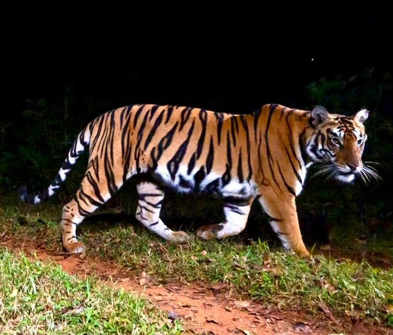
It is a prominent tiger reserve and part of the UNESCO World Network of Biosphere Reserves.
Asked in SSC CGL 2025
Practice (1)
Q575Which one of the following National Park–State pairs is correctly matched?
Show answer
Correct answer: B — Similipal National Park – Odisha
Answer: (B)Similipal National Park is in Mayurbhanj district, Odisha, so this pair is correctly matched.
The other three parks are real but placed in the wrong state. Namdapha is in Arunachal Pradesh, Bandipur in Karnataka and Vansda in Gujarat → option (b).
Why the others are wrong(a)Namdapha National Park – Nagaland: Namdapha is in Arunachal Pradesh, in Changlang district, not Nagaland. Both are north-eastern states, which is what makes the swap tempting.(c)Bandipur National Park – Andhra Pradesh: Bandipur is in Karnataka, in Chamarajanagar district, and became a tiger reserve under Project Tiger in 1973. It is not in Andhra Pradesh.(d)Vansda National Park – Rajasthan: Vansda is in Gujarat, in Navsari district on the Ambika river. Rajasthan's national parks include Ranthambore and Keoladeo, not Vansda.