
🌍 Geography भूगोल
1178 exam-ready facts · 1109 MCQs
-
201
The northern part of India's west coast is officially designated as the Konkan coast.
The Konkan coast extends from Daman in the north down to Goa in the south.
Asked in SSC CGL 2016 (6 Sep, Shift 2)
Practice (1)
Q200The northern part of the west coast in India is known as
Show answer
Correct answer: A — Konkan coast
Answer: (A)
The correct option is (A). -
202
The North-South corridor links Srinagar in the north to Kanyakumari in the south.
This mega corridor is a crucial component of India's National Highways Development Project.
Asked in SSC CGL 2023 (21 Jul, Shift 1)
Practice (1)
Q201The North-South corridor links which of the two major cities?
Show answer
Correct answer: D — Srinagar and Kanyakumari
Answer: (D)
The North–South corridor of the Golden Quadrilateral project links Srinagar and Kanyakumari. -
203
The Musi and Bhima are tributaries of the Krishna river.
The Krishna river is one of the major peninsular rivers of India, flowing east into the Bay of Bengal.
Asked in SSC CGL 2018
Practice (1)
Q202The Musi and Bhima are tributaries of the river ______.
Show answer
Correct answer: C — ['3', 'Krishna']
Answer: (C)
The correct option is (C). -
204
Thailand is famously known as the 'Land of White Elephants' due to the sacred significance of white elephants.
Historically, white elephants were considered sacred and owned exclusively by monarchs.
Asked in SSC CGL 2016 (2 Sep, Shift 2)
Practice (1)
Q203Which of the following is called the Land of White Elephants?
Show answer
Correct answer: A — Thailand
Answer: (A)
The correct option is (A). -
205
According to the Malthusian theory, population grows geometrically while food supply grows arithmetically.
This mismatch leads to resource crises and checks on population.
Asked in SSC CGL 2016 (3 Sep, Shift 2)
Practice (1)
Q204According to Malthusian theory of population<br>__________
Show answer
Correct answer: A — Population increases in geometric ratio, food supply increases in arithmetic ratio
Answer: (A)
The correct option is (A). -
206
Information Technology (IT) is widely known as a 'Sunrise Industry' due to its high growth rate and immense future potential.
Sunrise industries typically feature emerging technologies and rapid expansion.
Asked in SSC CGL 2016 (31 Aug, Shift 2)
Practice (1)
Q205Which one of the following industries is known as 'Sunrise Industry' ?
Show answer
Correct answer: C — Information Technology
Answer: (C)
The correct option is (C). -
207
The chromosphere is a reddish and glowing layer of gas situated just above the photosphere of the Sun.
It is about 2,000 kilometers thick and lies beneath the corona.
Asked in SSC CGL 2016 (10 Sep, Shift 3)
Practice (1)
Q206The outermost layer of sun is called
Show answer
Correct answer: B — Chromosphere
Answer: (B)
The correct option is (B). -
208
Madhya Pradesh holds the largest total forest cover by area in India.
According to the India State of Forest Report (ISFR), it leads other states in forest extent.
Asked in SSC CGL 2020 (5 Mar, Shift 1)
Practice (1)
Q207In terms of area, which state has the largest forest cover in India?
Show answer
Correct answer: B — Madhya Pradesh
Answer: (B)
Madhya Pradesh has the largest forest cover by area (ISFR 2019). -
209
A sea cave is a primary coastal landform created predominantly by wave erosion.
Sea caves form where waves relentlessly pound into zones of weakness in sea cliffs.
Asked in SSC CGL 2016
Practice (1)
Q208The land forms formed by wave erosion is
Show answer
Correct answer: C — Cave
Answer: (C)
The correct option is (C). -
210
Baglihar Dam is constructed on the Chenab river.
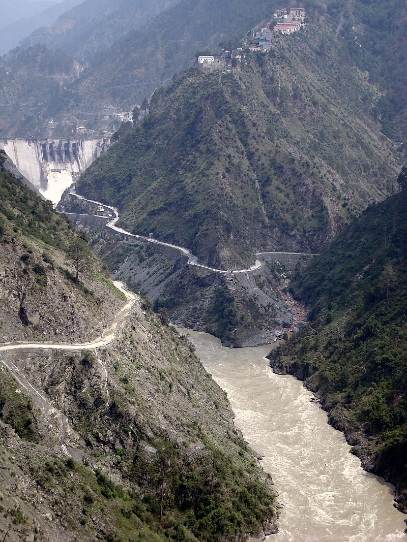
Baglihar Hydroelectric Power Project is a run-of-the-river power project located in the Ramban district of Jammu and Kashmir.
Asked in SSC CGL 2018
Practice (1)
Q209Baglihar Dam is constructed on which river?
Show answer
Correct answer: D — ['4', 'Chenab']
Answer: (D)
The correct option is (D). -
211
Bihar has historically recorded one of the lowest literacy rates in India.
Educational attainment varies significantly across Indian states.
Asked in SSC CGL 2016 (6 Sep, Shift 2)
Practice (1)
Q210Which of the following states has the lowest literacy rate?
Show answer
Correct answer: C — Bihar
Answer: (C)
The correct option is (C). -
212
The sun shines vertically over the equator twice a year, during the spring and autumn equinoxes.
These equinoxes occur around March 21 and September 23.
Asked in SSC CGL 2016 (10 Sep, Shift 2)
Practice (1)
Q211When does the sun shine vertically on the Equator ?
Show answer
Correct answer: C — Twice a year
Answer: (C)
The correct option is (C). -
213
Hachures are short, disconnected lines drawn on maps to indicate the direction and steepness of a slope.
Steeper slopes are shown with closer and thicker hachure lines.
Asked in SSC CGL 2016 (2 Sep, Shift 2)
Practice (1)
Q212The disconnected lines drawn on a map for showing slope -
Show answer
Correct answer: D — Hachure
Answer: (D)
The correct option is (D). -
214
Wind energy is considered one of the cleanest and most sustainable sources of renewable energy.
It produces no greenhouse gas emissions or harmful pollutants during operation.
Asked in SSC CGL 2016 (30 Aug, Shift 3)
Practice (1)
Q213Which of the following is the cleanest source of energy?
Show answer
Correct answer: D — Wind energy
Answer: (D)
The correct option is (D). -
215
Sonitpur Elephant Reserve is a prominent elephant habitat located in the state of Assam.
Elephant reserves in Odisha include Mayurbhanj, Mahanadi, and Sambalpur-Lemru.
Asked in SSC CGL 2020 (5 Mar, Shift 2)
Practice (1)
Q214Which of the following is NOT located in Odisha?
Show answer
Correct answer: C — Sonitpur Elephant Reserve
Answer: (C)
Sonitpur Elephant Reserve is in Assam. -
216
Haldia port is situated on the east coast of India in West Bengal.
Ports like Mangaluru, Kandla, and Marmagao are located on the western coast.
Asked in SSC CGL 2023 (24 Jul, Shift 1)
Practice (1)
Q215Which of the following ports is NOT situated on the west coast of India?
Show answer
Correct answer: D — Haldia
Answer: (D)
Haldia is on the east coast (West Bengal). -
217
The Ganga-Brahmaputra Valley is one of the regions in India most prone to severe earthquakes due to its tectonic setting.
This region lies in close proximity to the seismically active Himalayan collision zone.
Asked in SSC CGL 2016 (6 Sep, Shift 1)
Practice (1)
Q216Which of the following areas or regions is most prone to earthquakes?
Show answer
Correct answer: B — Ganga-Brahmaputra Valley
Answer: (B)
The correct option is (B). -
218
The boundary line demarcating India and Pakistan is internationally known as the Radcliffe Line.
The Radcliffe Line was drawn up by Sir Cyril Radcliffe in 1947 during the partition of India.
Asked in SSC CGL 2016 (6 Sep, Shift 1)
Practice (1)
Q217Which of the following border is known as Radcliffe line ?
Show answer
Correct answer: C — India and Pakistan
Answer: (C)
The correct option is (C). -
219
An archipelago is a group or chain of interconnected islands closely scattered in a body of water.
Indonesia is one of the largest archipelagic states in the world.
Asked in SSC CGL 2016 (2 Sep, Shift 2)
Practice (1)
Q218A group of inter-connected islands is known as __________ .
Show answer
Correct answer: C — Archipelago
Answer: (C)
The correct option is (C). -
220
Acceleration due to gravity is maximum at the Earth's poles due to the oblate spheroid shape and less centrifugal force.
The Earth's radius is smallest at the poles, which increases gravitational pull.
Asked in SSC CGL 2017 (8 Aug, Shift 2)
Practice (1)
Q219Gravitational force is maximum at which of the following place?
Show answer
Correct answer: D — At poles
Answer: (D)
g is greatest at the poles because the Earth's radius is smallest there and there is no centrifugal reduction.