
🗺️ India: Physical Features भारत: भौतिक स्वरूप
227 exam-ready facts · 227 MCQs
-
201
The Shevaroy Hills, located near Yercaud in Tamil Nadu, form an integral part of the Eastern Ghats.
The Eastern Ghats are a discontinuous range of mountains along India's eastern coast.
Asked in SSC CGL 2024 (12 Sep, Shift 2)
Practice (1)
Q201Which of the following hills is located in the Eastern Ghats?
Show answer
Correct answer: A — Shevaroy hills
Answer: (A)
The Shevaroy hills (Yercaud, Tamil Nadu) are part of the Eastern Ghats. Khasi and Naga hills are in the north-east; Anamudi is in the Western Ghats. -
202
Khadins are traditional agricultural runoff-harvesting structures uniquely designed and used in Jaisalmer, Rajasthan.
This system allows water to saturate the soil before cultivation of crops.
Asked in SSC CGL 2024 (12 Sep, Shift 3)
Practice (1)
Q202Identify a water-harvesting system found in Jaisalmer.
Show answer
Correct answer: C — Khadins
Answer: (C)
Khadins are runoff-farming structures of Jaisalmer, Rajasthan. -
203
The Brahmaputra River marks the eastern-most natural boundary and gorge section of the Himalayan mountain range.
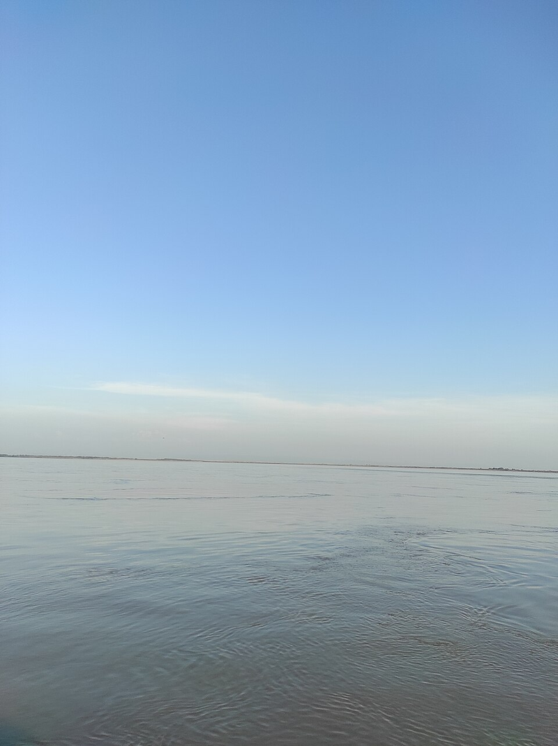
The Indus River marks the western-most boundary of the Himalayas.
Asked in SSC CGL 2024
Practice (1)
Q203Which of the following rivers marks the eastern-most boundary of the Himalayas?
Show answer
Correct answer: D — Brahmaputra
Answer: (D)
The Himalayas run from the Indus in the west to the Brahmaputra in the east. -
204
Exfoliation, often referred to as onion-peel weathering, is a type of physical weathering caused by thermal expansion.
Repeated heating and cooling causes the outer rock layers to peel off.
Asked in SSC CGL 2024 (13 Sep, Shift 2)
Practice (1)
Q204Exfoliation is a form of _________.
Show answer
Correct answer: C — physical weathering
Answer: (C)
Exfoliation (onion-peel weathering) comes from repeated heating and cooling, which makes it physical weathering. -
205
The Gulf of Mannar is a shallow bay located between the south-eastern tip of India and the western coast of Sri Lanka.
It is famous for its rich marine biodiversity and pearl fishery.
Asked in SSC CGL 2024 (13 Sep, Shift 3)
Practice (1)
Q205Where is the Gulf of Mannar located?
Show answer
Correct answer: D — Between the south-eastern tip of India and the western coast of Sri Lanka
Answer: (D)
The Gulf of Mannar lies between the south-eastern tip of India and the west coast of Sri Lanka. -
206
Majuli, situated on the Brahmaputra River in Assam, is recognized as the largest inhabited riverine island in the world.
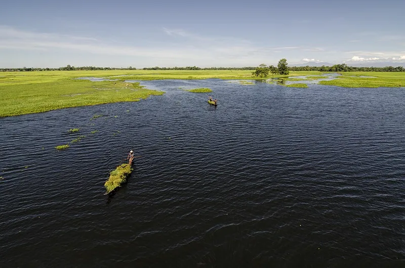
It has a unique cultural heritage tied to the Neo-Vaishnavite satras.
Asked in SSC CGL 2024
Practice (1)
Q206Which of the following is the largest inhabited riverine island in the world?
Show answer
Correct answer: C — Majuli
Answer: (C)
Majuli (Assam) is the largest inhabited river island. -
207
New Moore Island, also known as South Talpatti, was an island situated in geographical proximity to Bangladesh in the Bay of Bengal.
The island was eventually submerged due to rising sea levels.
Asked in SSC CGL 2024
Practice (1)
Q207The New Moore Island is in geographic proximity to:
Show answer
Correct answer: A — Bangladesh
Answer: (A)
New Moore (South Talpatti) Island lies near Bangladesh in the Bay of Bengal. -
208
Mawsynram, which receives the highest average annual rainfall in the world, is located in the southern ranges of the Khasi Hills.
The funnel-shaped relief of the Khasi hills traps moisture-laden monsoon winds.
Asked in SSC CGL 2024 (25 Sep, Shift 3)
Practice (1)
Q208In the southern ranges of which hills is Mawsynram, which receives the highest rainfall in the world, located?
Show answer
Correct answer: C — Khasi hills
Answer: (C)
Mawsynram lies in the Khasi Hills of Meghalaya. -
209
Hanging valleys often occur at elevations along main glacial valleys, and their spurs are frequently truncated into triangular facets.
Glacial erosion creates hanging valleys that drop steeply into the main valley floor.
Asked in SSC CGL 2025 (12 Sep, Shift 1)
Practice (1)
Q209Consider the following statements about glacial landforms:<br>Statement 1: Hanging valleys are often found opening into main glacial valleys at higher elevations.<br>Statement 2: Spurs of such hanging valleys are frequently truncated into triangular facets.<br>Which of the following Statements is/are Correct?
Show answer
Correct answer: C — 1 and 2 are correct
Answer: (C)Both statements come almost word for word from NCERT's Class XI Fundamentals of Physical Geography.
It says there can be hanging valleys at an elevation on one or both sides of the main glacial valley. It adds that the spurs of such hanging valleys opening into the main valley are quite often truncated into triangular facets.
So statements 1 and 2 are both correct.
Why the others are wrong(a)Only 1: It drops a true statement. NCERT itself says the spurs of hanging valleys opening into the main valley are quite often truncated into triangular facets.(b)Only 2: It drops the statement NCERT puts first: hanging valleys sit at an elevation on one or both sides of the main glacial valley.(d)Neither 1 nor 2 are correct: Both lines restate NCERT's description of glacial troughs, so rejecting both means rejecting the textbook's own account of a glaciated valley. -
210
A slump is a type of landslide characterized by the backward rotation of slipping rock debris along a slope.
Slumping involves rotational movement along a curved failure surface.
Asked in SSC CGL 2025 (12 Sep, Shift 2)
Practice (1)
Q210Which of the following types of landslides involves backward rotation of the slipping material?
Show answer
Correct answer: C — Slump
Answer: (C)NCERT's Class XI Fundamentals of Physical Geography defines slump as the slipping of one or several units of rock debris with a backward rotation with respect to the slope over which the movement takes place.
It sets slump against debris slide, the rapid rolling or sliding of earth debris without that rotation → option (c).
Why the others are wrong(a)Rockslide: A rockslide is individual rock masses sliding down bedding, joint or fault surfaces. NCERT's definition carries no backward rotation.(b)Rock fall: Rock fall is the free fall of rock blocks over a steep slope, keeping away from the slope. The rock falls clear, so nothing slips or rotates.(d)Debris fall: Debris fall is a nearly free fall of earth debris from a vertical or overhanging face. It drops rather than slipping along the slope. -
211
A is true, but R is false. (Read the following Assertion (A) and Reason (R) carefully and choose the correct option:<br>Assertion (A): The Chotanagp)
Asked in SSC CGL 2025 (12 Sep, Shift 3)
Practice (1)
Q211Read the following Assertion (A) and Reason (R) carefully and choose the correct option:<br>Assertion (A): The Chotanagpur Plateau is considered an eastern extension of the Central Highlands.<br>Reason (R): The Chotanagpur Plateau is drained primarily by the Chambal and Betwa rivers.
Show answer
Correct answer: C — A is true, but R is false
Answer: (C)A is true. NCERT's Class IX geography text says the Central Highlands extend eastward as Bundelkhand and Baghelkhand, and that the Chotanagpur plateau marks the further eastward extension.
R is false. The same passage says Chotanagpur is drained by the Damodar. The Chambal and the Betwa drain the Central Highlands farther west. A true, R false: option (c).
Why the others are wrong(a)Both A and R are true, and R is the correct explanation of A: R is false, so it cannot explain A. The Chambal and Betwa are Yamuna tributaries draining the Central Highlands farther west, while Chotanagpur is drained by the Damodar.(b)Both A and R are true, but R is not the correct explanation of A: This needs R to be true. Chotanagpur's river is the Damodar, which NCERT places on the plateau's eastern margins, flowing through a rift valley.(d)A is false, but R is true: A is true, not false. NCERT describes Chotanagpur as the further eastward extension of the Central Highlands, beyond Bundelkhand and Baghelkhand. -
212
Streams in the Indian Desert appear during the rainy season and quickly disappear into the sand without reaching the sea.
Low annual rainfall and high evaporation cause ephemeral stream behavior in desert regions.
Asked in SSC CGL 2025 (14 Sep, Shift 1)
Practice (1)
Q212Which statements accurately describe water bodies in the Indian Desert?<br>1. Streams are perennial and flow year-round.<br>2. Most streams disappear into the sand.
Show answer
Correct answer: B — Only 2
Answer: (B)NCERT's Class IX geography says the Indian Desert's streams appear in the rainy season and soon disappear into the sand, lacking the water to reach the sea.
So statement 2 stands and statement 1, perennial streams, fails. Rainfall is below 150 mm a year, and even the Luni, the region's large river, is ephemeral.
Why the others are wrong(a)Only 1: Reverses the facts. NCERT calls the desert's rivers ephemeral: streams run in the rainy season and then vanish into the sand.(c)1 and 2 both are correct: Statement 1 is false. With rainfall below 150 mm a year, streams cannot flow year-round, and NCERT calls the desert's rivers ephemeral.(d)Neither 1 nor 2 are correct: Statement 2 is true. NCERT says the desert's streams disappear into the sand soon after the rains, since they cannot reach the sea. -
213
India's total land area covers approximately 3.28 million square kilometers, accounting for 2.4 percent of the world's total area.
This geographic share makes India the seventh largest country in the world by total landmass.
Asked in SSC CGL 2025 (15 Sep, Shift 1)
Practice (1)
Q213India's land area covers what percentage of the world's total area?
Show answer
Correct answer: B — 2.4%
Answer: (B)NCERT's Class 9 geography gives India's landmass as 3.28 million sq km, about 2.4 per cent of the total geographical area of the world.
That share makes India the seventh largest country by area → option (b).
Why the others are wrong(a)1.4%: 1.4% is too low. At that share, India's 3.28 million sq km would imply a world land area of about 234 million sq km, far more than Earth's roughly 149 million.(c)3.4%: 3.4% overstates India's share. It would imply a world land area of only about 96 million sq km, well short of Earth's roughly 149 million.(d)4.4%: 4.4% is further off still. It would imply a world land area of about 75 million sq km, roughly half of Earth's actual land. -
214
A stalagmite rises upward from the cave floor, formed by mineral-rich water dripping from the ceiling.
Calcium carbonate precipitates out of the dripping water to build limestone formations over time.
Asked in SSC CGL 2025 (13 Sep, Shift 2)
Practice (1)
Q214Choose the correctly matched cave feature and its formation:
Show answer
Correct answer: B — Stalagmite – Formed by dripping water from cave ceiling
Answer: (B)A stalagmite rises from the cave floor, but the water that builds it comes from above. Water carrying dissolved calcium carbonate drips from the ceiling, usually after running down a stalactite, and deposits the mineral where it lands.
So option (b) pairs the stalagmite with its real source: ceiling drippings, building upward from the floor.
Why the others are wrong(a)Stalactite – Grows upward from cave floor: That describes a stalagmite, not a stalactite. Stalactites hang down from the ceiling; the stalagmite is the one that grows upward from the floor.(c)Pillar – Hangs from the cave roof: A pillar, or column, forms when a stalactite and a stalagmite grow until they join, so it links floor and roof rather than hanging from the roof.(d)Stalactite – Formed by upward mineral flow: A stalactite grows downward from the ceiling, deposited by water seeping and dripping from above, not by an upward flow of minerals. -
215
Major coral reef ecosystems in India are restricted to the Gulf of Kutch, Gulf of Mannar, Lakshadweep, and Andaman & Nicobar Islands.
Warm, shallow, and clear marine waters provide the ideal habitat for coral polyp growth.
Asked in SSC CGL 2025 (15 Sep, Shift 2)
Practice (1)
Q215Which of the following sets of locations in India is known for having significant coral reef ecosystems?
Show answer
Correct answer: C — Gulf of Kutch, Gulf of Mannar, Lakshadweep, and Andaman & Nicobar Islands
Answer: (C)An FAO review of India's coral reefs says the major reef formations are restricted to the Gulf of Mannar, Palk Bay, the Gulf of Kutch, the Andaman and Nicobar Islands and the Lakshadweep islands.
Option (c) names four of those five areas: gulfs and island groups with the warm, shallow, clear water corals need → option (c).
Why the others are wrong(a)Bay of Bengal coast and deltas: River deltas are where reefs fail. The FAO review attributes the lack of reefs on the Bay of Bengal coast to the immense quantity of freshwater and silt its rivers bring.(b)East coast of India near major river mouths: River mouths pour out the freshwater and silt that keep reefs off the Bay of Bengal coast. The mainland east-coast reef areas the FAO review names are the Gulf of Mannar and Palk Bay.(d)Deep-sea trenches in the Indian Ocean: Deep-sea trenches are the ocean's deepest, darkest parts. NCERT describes corals as living mainly in warm, shallow sea water. -
216
Glacial till is an unsorted mixture of coarse and fine debris deposited directly by melting ice.
Unlike water-laid sediments, till lacks stratification and contains angular rock fragments.
Asked in SSC CGL 2025 (15 Sep, Shift 3)
Practice (1)
Q216Which of the following best distinguishes glacial till from water-laid glacial sediments?
Show answer
Correct answer: C — It is an unsorted mix of materials deposited directly by ice.
Answer: (C)NCERT defines glacial till as "the unassorted coarse and fine debris dropped by the melting glaciers". Most of its rock fragments are angular to sub-angular.
Water-laid outwash is the opposite: roughly stratified and assorted, with somewhat rounded fragments. Till is told apart by being unsorted and dropped directly by ice → option (c).
Why the others are wrong(a)It is layered and stratified due to flowing meltwater.: Layering by meltwater describes outwash, which NCERT calls roughly stratified and assorted. Till is unassorted.(b)It is composed of uniformly sized, rounded particles.: Rounded, evenly sized grains are the mark of water sorting. Till mixes coarse and fine debris, mostly angular to sub-angular.(d)It forms only in glacial lakes through sediment settling.: Settling in a lake is a water-laid process. Till is dropped by the ice itself, in moraines and in sheets over valley floors. -
217
It affects material to considerable depth. (Which of the following statements about rockslide is correct?)
Asked in SSC CGL 2025 (14 Sep, Shift 2)
Practice (1)
Q217Which of the following statements about rockslide is correct?
Show answer
Correct answer: D — It affects material to considerable depth
Answer: (D)NCERT's Class XI Fundamentals of Physical Geography defines rockslide as the sliding of individual rock masses down bedding, joint or fault surfaces.
It then separates it from rock fall. Rock falls occur from the superficial layers of the rock face, which distinguishes them from rockslide, which affects materials up to a substantial depth. That is option (d).
Why the others are wrong(a)It affects only the outermost layer of the rock face: That is rock fall, not rockslide. NCERT says rock falls occur from the superficial layers of the rock face, and uses exactly that to set them apart from rockslide.(b)It is slower than rock fall: NCERT sets no such speed ranking. It calls rock sliding over steep slopes very fast and destructive, and the difference it draws from rock fall is depth, not speed.(c)It involves backward rotation of debris: Backward rotation defines a slump, the slipping of rock debris with a backward rotation relative to the slope. A debris slide, NCERT adds, moves without that rotation. -
218
Lateral erosion in flat terrain. (What causes a river to develop meanders?)
Asked in SSC CGL 2025 (16 Sep, Shift 2)
Practice (1)
Q218What causes a river to develop meanders?
Show answer
Correct answer: C — Lateral erosion in flat terrain
Answer: (C)Meanders form where a river crosses gentle, flat ground and its erosion works sideways rather than downwards.
On each bend the flow is fastest on the outside, so it erodes the outer (cut) bank and drops sediment on the inner bank as a point bar. The bends grow and migrate across the floodplain: lateral erosion in flat terrain.
Why the others are wrong(a)High-altitude origin: A high-altitude origin puts a river on steep slopes, where it cuts downwards into V-shaped valleys and gorges. Meanders belong to low, gentle ground, usually far from the source.(b)Sudden tectonic uplift: Tectonic uplift makes a river cut down. A meandering river on rising land sinks its existing bends into rock as incised meanders, so uplift deepens loops rather than creating them.(d)Ocean current influence: Ocean currents act at sea and along coasts. A river's bends form inland, from its own flow working on its banks. -
219
Pillar – Formed by union of stalactite and stalagmite. (Which of the following pairs is correctly matched with reference to limestone cave formations?)
Asked in SSC CGL 2025 (18 Sep, Shift 1)
Practice (1)
Q219Which of the following pairs is correctly matched with reference to limestone cave formations?
Show answer
Correct answer: C — Pillar – Formed by union of stalactite and stalagmite
Answer: (C)Water dripping into a limestone cave deposits calcium carbonate at both ends of its fall.
The deposit hanging from the roof is a stalactite. The one rising from the floor, where the drops land, is a stalagmite.
When the two grow long enough to meet, they form a pillar (column): option (c).
Why the others are wrong(a)Stalactite – Rises from cave floor: Reversed. A stalactite hangs from the roof; it is the stalagmite that rises from the floor.(b)Stalagmite – Hangs from cave roof: Reversed again. A stalagmite rises from the floor; the formation hanging from the roof is the stalactite.(d)Stalagmite – Formed by water falling from floor: Water does not fall from the floor. A stalagmite builds up where water dripping from the roof lands on the floor. -
220
Bisht Doab - between Beas and Chenab. (Which of the given pairs is NOT matched correctly?)
Asked in SSC CGL 2025 (19 Sep, Shift 2)
Practice (1)
Q220Which of the given pairs is NOT matched correctly?
Show answer
Correct answer: B — Bisht Doab - between Beas and Chenab
Answer: (B)The Bist Doab lies between the Beas and the Sutlej, not the Beas and the Chenab.
Line the rivers up west to east, Indus, Jhelum, Chenab, Ravi, Beas, Sutlej, and each Punjab doab takes one neighbouring pair. The Beas and the Chenab are not neighbours, since the Ravi flows between them → option (b).
Why the others are wrong(a)Bari Doab - between Beas and Ravi: Correct pairing: the Bari Doab is the land between the Beas and the Ravi, and its name is built from those two rivers.(c)Rachna Doab - between Ravi and Chenab: Correct pairing: the Rachna (Rechna) Doab lies between the Ravi and the Chenab, Ra- for Ravi and -chna for Chenab.(d)Jech Doab - between Chenab and Jhelum: Correct pairing: the Jech (Chaj) Doab lies between the Chenab and the Jhelum, the two rivers whose initials give it its name.