
🗺️ India: Physical Features भारत: भौतिक स्वरूप
227 exam-ready facts · 227 MCQs
-
201
Tamil Nadu mein Yercaud ke paas situated Shevaroy Hills Eastern Ghats ka an integral part hain.
Eastern Ghats India ke eastern coast ke sath mountains ki ek discontinuous range hai.
Asked in SSC CGL 2024 (12 Sep, Shift 2)
Practice (1)
Q201निम्नलिखित में से कौन सी पहाड़ी पूर्वी घाट में स्थित है?
Answer dekho
Sahi uttar: A — शेवरॉय पहाड़ियाँ
शेवरॉय पहाड़ियाँ (यारकॉड, तमिलनाडु) पूर्वी घाट का हिस्सा हैं। खासी और नागा पहाड़ियाँ उत्तर-पूर्व में हैं; अनामुडी पश्चिमी घाट में है। -
202
Khadins traditional agricultural runoff-harvesting structures hain jo uniquely Jaisalmer, Rajasthan mein design aur use ki jaati hain.
Yeh system crops ki cultivation se pehle soil ko water se saturate karne ki permission deta hai.
Asked in SSC CGL 2024 (12 Sep, Shift 3)
Practice (1)
Q202जैसलमेर में पाई जाने वाली जल-संचयन प्रणाली की पहचान करें।
Answer dekho
Sahi uttar: C — खादिन
उत्तर: (C)
खादिन जैसलमेर, राजस्थान की अपवाह-खेती संरचनाएं हैं। -
203
Brahmaputra River Himalayan mountain range ki eastern-most natural boundary aur gorge section ko mark karti hai.
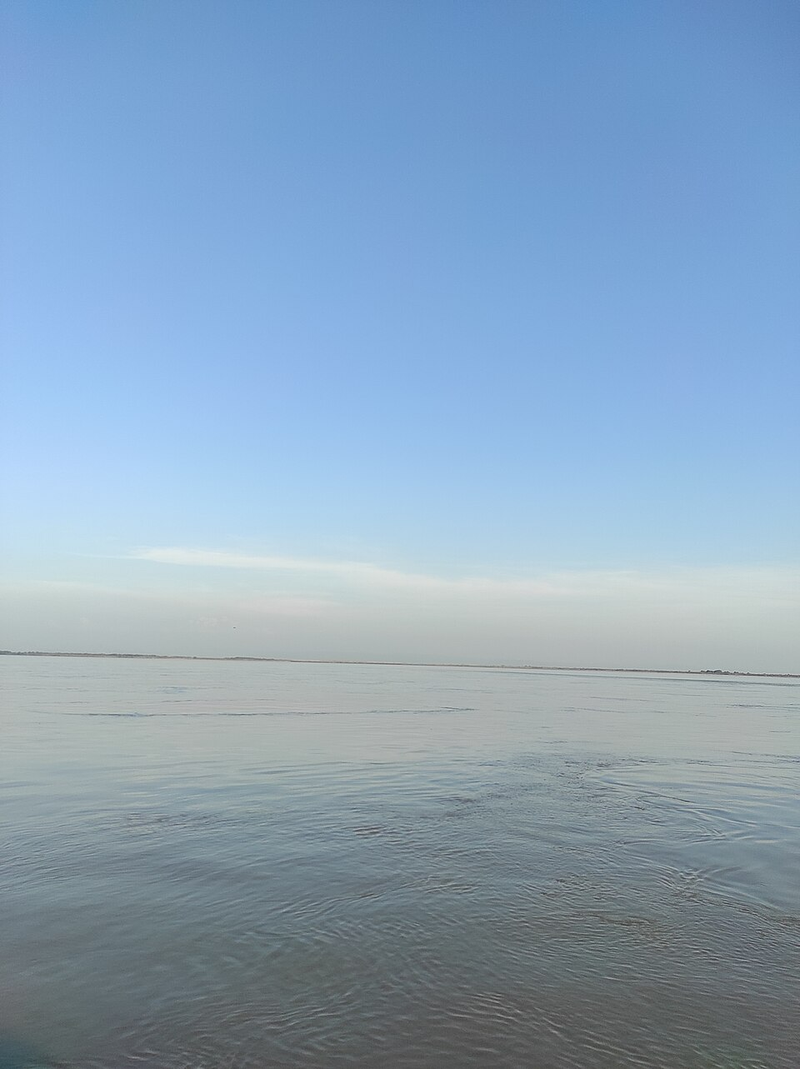
Indus River Himalayas ki western-most boundary ko mark karti hai.
Asked in SSC CGL 2024
Practice (1)
Q203निम्नलिखित में से कौन सी नदी हिमालय की सबसे पूर्वी सीमा को चिह्नित करती है?
Answer dekho
Sahi uttar: D — ब्रह्मपुत्र
उत्तर: (D)
हिमालय पश्चिम में सिंधु से लेकर पूर्व में ब्रह्मपुत्र तक फैला हुआ है। -
204
Exfoliation, jise onion-peel weathering bhi kehte hain, thermal expansion ki wajah se hone wala physical weathering ka ek type hai.
Baar-baar hot aur cool hone se rock ki outer layers peel off hone lagti hain.
Asked in SSC CGL 2024 (13 Sep, Shift 2)
Practice (1)
Q204उत्पल्कन (Exfoliation) ________ का एक रूप है।
Answer dekho
Sahi uttar: C — भौतिक अपक्षय
उत्तर: (C)
उत्पल्कन (प्याज के छिलके जैसी अपक्षय) बार-बार गर्म और ठंडे होने से होता है, जो इसे भौतिक अपक्षय बनाता है। -
205
Gulf of Mannar ek shallow bay hai jo India ke south-eastern tip aur Sri Lanka ke western coast ke beech located hai.
Yeh apni rich marine biodiversity aur pearl fishery ke liye famous hai.
Asked in SSC CGL 2024 (13 Sep, Shift 3)
Practice (1)
Q205मन्नार की खाड़ी कहाँ स्थित है?
Answer dekho
Sahi uttar: D — भारत के दक्षिण-पूर्वी टिप और श्रीलंका के पश्चिमी तट के बीच
उत्तर: (D)
मन्नार की खाड़ी भारत के दक्षिण-पूर्वी छोर और श्रीलंका के पश्चिमी तट के बीच स्थित है। -
206
Assam mein Brahmaputra River par situated Majuli, world ka largest inhabited river island maana jata hai.
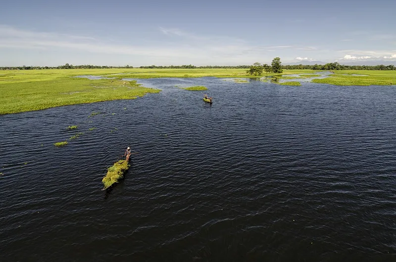
Iska ek unique cultural heritage hai jo Neo-Vaishnavite satras se juda hai.
Asked in SSC CGL 2024
Practice (1)
Q206निम्नलिखित में से कौन दुनिया का सबसे बड़ा बसा हुआ नदी द्वीप है?
Answer dekho
Sahi uttar: C — माजुली
उत्तर: (C)
माजुली (असम) सबसे बड़ा बसा हुआ नदी द्वीप है। -
207
New Moore Island, jise South Talpatti bhi kehte hain, Bay of Bengal mein Bangladesh ke paas situated ek island tha.
Sea levels ke rise hone ki wajah se yeh island submerge ho gaya.
Asked in SSC CGL 2024
Practice (1)
Q207The New Moore Island is in geographic proximity to:
Answer dekho
Sahi uttar: A — Bangladesh
Answer: (A)
New Moore (South Talpatti) Island lies near Bangladesh in the Bay of Bengal. -
208
Mawsynram, jahan world ki highest rainfall hoti hai, Khasi Hills ki southern ranges mein situated hai.
Khasi hills ka funnel-shaped relief moisture-laden monsoon winds ko trap kar leta hai.
Asked in SSC CGL 2024 (25 Sep, Shift 3)
Practice (1)
Q208दुनिया में सबसे अधिक वर्षा प्राप्त करने वाला मौसिनराम किस पहाड़ी की दक्षिणी श्रृंखलाओं में स्थित है?
Answer dekho
Sahi uttar: C — खासी पहाड़ियाँ
उत्तर: (C)
मौसिनराम मेघालय की खासी पहाड़ियों में स्थित है। -
209
Latakati ghatiyaan mukhya himnad ghatiyon ke sath uchch unchaiyon par aksar pai jati hain, aur aisi ghatiyon ke nukile bhag aksar tribhujakar falakon mein kate hote hain.
Himnad apardan latakati ghatiyon ka nirman karta hai jo mukhya ghati ke tal par tivrata se girti hain.
Asked in SSC CGL 2025 (12 Sep, Shift 1)
Practice (1)
Q209हिमनद आकृतियों के बारे में निम्नलिखित कथनों पर विचार करें:<br>कथन 1: लटकती घाटियाँ (Hanging valleys) अक्सर मुख्य हिमनद घाटियों में उच्च ऊँचाइयों पर खुलती पाई जाती हैं।<br>कथन 2: ऐसी लटकती घाटियों के कटक (Spurs) अक्सर त्रिभुजाकार फलकों (Triangular facets) में कटे होते हैं।<br>निम्नलिखित में से कौन सा/से कथन सही है/हैं?
Answer dekho
Sahi uttar: C — 1 और 2 दोनों सही हैं
उत्तर: (C) दोनों कथन एनसीईआरटी की भौतिक भूगोल की पाठ्यपुस्तक से हैं और सही हैं। -
210
Slump bhuskhalan ka ek prakar hai jo dhalan ke sath fisalne wale chattani malbe ke piche ki or ghumne ki visheshta rakhta hai.
Slumping mein ek ghumavdar vifalta satah ke sath ghurni gati shamil hoti hai.
Asked in SSC CGL 2025 (12 Sep, Shift 2)
Practice (1)
Q210निम्नलिखित में से किस प्रकार के भूस्खलन में फिसलने वाली सामग्री का पीछे की ओर घूर्णन (Backward rotation) शामिल होता है?
Answer dekho
Sahi uttar: C — स्लंप (Slump)
उत्तर: (C) एनसीईआरटी के अनुसार, स्लंप वह प्रक्रिया है जिसमें चट्टान या मलबा ढलान के सापेक्ष पीछे की ओर घूमते हुए फिसलता है। -
211
A is true, but R is false
Asked in SSC CGL 2025 (12 Sep, Shift 3)
Practice (1)
Q211Read the following Assertion (A) and Reason (R) carefully and choose the correct option:<br>Assertion (A): The Chotanagpur Plateau is considered an eastern extension of the Central Highlands.<br>Reason (R): The Chotanagpur Plateau is drained primarily by the Chambal and Betwa rivers.
Answer dekho
Sahi uttar: C — A is true, but R is false
Answer: (C)A is true. NCERT's Class IX geography text says the Central Highlands extend eastward as Bundelkhand and Baghelkhand, and that the Chotanagpur plateau marks the further eastward extension.
R is false. The same passage says Chotanagpur is drained by the Damodar. The Chambal and the Betwa drain the Central Highlands farther west. A true, R false: option (c).
Why the others are wrong(a)Both A and R are true, and R is the correct explanation of A: R is false, so it cannot explain A. The Chambal and Betwa are Yamuna tributaries draining the Central Highlands farther west, while Chotanagpur is drained by the Damodar.(b)Both A and R are true, but R is not the correct explanation of A: This needs R to be true. Chotanagpur's river is the Damodar, which NCERT places on the plateau's eastern margins, flowing through a rift valley.(d)A is false, but R is true: A is true, not false. NCERT describes Chotanagpur as the further eastward extension of the Central Highlands, beyond Bundelkhand and Baghelkhand. -
212
Bharatiya registan mein dharaen varsha ritu mein prakat hoti hain aur samudra tak pahunche bina jaldi hi ret mein lupt ho jati hain.
Kam varshik varsha aur uchch vashpikaran registani kshetro mein alpkalik nadi vyavahar ka karan bante hain.
Asked in SSC CGL 2025 (14 Sep, Shift 1)
Practice (1)
Q212कौन से कथन भारतीय मरुस्थल में जल निकायों का सटीक वर्णन करते हैं?<br>1. धाराएँ बारहमासी होती हैं और वर्ष भर बहती हैं।<br>2. अधिकांश धाराएँ रेत में विलीन हो जाती हैं।
Answer dekho
Sahi uttar: B — केवल 2
उत्तर: (B) मरुस्थल की नदियाँ अल्पकालिक (ephemeral) होती हैं जो वर्षा में बहती हैं और रेत में विलीन हो जाती हैं, इसलिए केवल कथन 2 सही है। -
213
Bharat ka kul bhubhag lagbhag 3.28 million varg kilometer hai, jo duniya ke kul kshetrafal ka 2.4 pratishat hai.
Yah bhaugolik hissa Bharat ko kul bhubhag ke mamle mein duniya ka satwan sabse bada desh banata hai.
Asked in SSC CGL 2025 (15 Sep, Shift 1)
Practice (1)
Q213भारत का कुल भूक्षेत्र दुनिया के कुल क्षेत्रफल का कितना प्रतिशत है?
Answer dekho
Sahi uttar: B — 2.4%
उत्तर: (B) भारत का क्षेत्रफल 3.28 मिलियन वर्ग किमी है जो विश्व के कुल क्षेत्रफल का 2.4% है। -
214
Stalagmite gufa ke farsh se upar ki or uthta hai, jo chhat se tapakne wale khanij yukt pani se banta hai.
Samay ke sath chuna patthar ki sanrachnaon ka nirman karne ke liye tapakte pani se calcium carbonate avakshepit hota hai.
Asked in SSC CGL 2025 (13 Sep, Shift 2)
Practice (1)
Q214गुफा की विशेषता और उसके निर्माण का सही मिलान चुनें:
Answer dekho
Sahi uttar: B — स्टैलग माइट – गुफा की छत से टपकते पानी से बनता है
उत्तर: (B) स्टैलगमाइट गुफा के फर्श पर बनता है और छत से टपकने वाले पानी के कारण ऊपर की ओर बढ़ता है। -
215
Bharat mein pramukh praval bhitti paristhitik tantra Kutch ki khari, Mannar ki khari, Lakshadweep aur Andaman evam Nicobar dwip samuh tak simit hain.
Garm, uthala aur saf samudri pani coral polyps ke vikas ke liye adarsh aawas pradan karta hai.
Asked in SSC CGL 2025 (15 Sep, Shift 2)
Practice (1)
Q215भारत में स्थानों का कौन सा समूह महत्वपूर्ण प्रवाल भित्ति (Coral reef) पारिस्थितिक तंत्र के लिए जाना जाता है?
Answer dekho
Sahi uttar: C — कच्छ की खाड़ी, मन्नार की खाड़ी, लक्षद्वीप और अंडमान और निकोबार द्वीप समूह
उत्तर: (C) भारत में मुख्य प्रवाल भित्तियाँ कच्छ की खाड़ी, मन्नार की खाड़ी, लक्षद्वीप और अंडमान-निकोबार में पाई जाती हैं। -
216
Himnad till pighalti barf dwara sidhe jama kiye gaye mote aur barik malbe ka ek avargikrit mishran hai.
Pani dwara bichai gayi talchhat ke viprit, till mein starikaran ka abhav hota hai aur isme kooniy chattann ke tukde hote hain.
Asked in SSC CGL 2025 (15 Sep, Shift 3)
Practice (1)
Q216निम्नलिखित में से कौन सा ग्लेशियल टिल को पानी से जमा हुए हिमनद अवसादों से सबसे अच्छी तरह अलग करता है?
Answer dekho
Sahi uttar: C — यह बर्फ द्वारा सीधे जमा की गई सामग्रियों का एक अवर्गीकृत मिश्रण है।
उत्तर: (C) ग्लेशियल टिल पिघलते हिमनदों द्वारा सीधे गिराया गया असंगठित और अवर्गीकृत मलबा होता है। -
217
It affects material to considerable depth
Asked in SSC CGL 2025 (14 Sep, Shift 2)
Practice (1)
Q217Which of the following statements about rockslide is correct?
Answer dekho
Sahi uttar: D — It affects material to considerable depth
Answer: (D)NCERT's Class XI Fundamentals of Physical Geography defines rockslide as the sliding of individual rock masses down bedding, joint or fault surfaces.
It then separates it from rock fall. Rock falls occur from the superficial layers of the rock face, which distinguishes them from rockslide, which affects materials up to a substantial depth. That is option (d).
Why the others are wrong(a)It affects only the outermost layer of the rock face: That is rock fall, not rockslide. NCERT says rock falls occur from the superficial layers of the rock face, and uses exactly that to set them apart from rockslide.(b)It is slower than rock fall: NCERT sets no such speed ranking. It calls rock sliding over steep slopes very fast and destructive, and the difference it draws from rock fall is depth, not speed.(c)It involves backward rotation of debris: Backward rotation defines a slump, the slipping of rock debris with a backward rotation relative to the slope. A debris slide, NCERT adds, moves without that rotation. -
218
Lateral erosion in flat terrain
Asked in SSC CGL 2025 (16 Sep, Shift 2)
Practice (1)
Q218What causes a river to develop meanders?
Answer dekho
Sahi uttar: C — Lateral erosion in flat terrain
Answer: (C)Meanders form where a river crosses gentle, flat ground and its erosion works sideways rather than downwards.
On each bend the flow is fastest on the outside, so it erodes the outer (cut) bank and drops sediment on the inner bank as a point bar. The bends grow and migrate across the floodplain: lateral erosion in flat terrain.
Why the others are wrong(a)High-altitude origin: A high-altitude origin puts a river on steep slopes, where it cuts downwards into V-shaped valleys and gorges. Meanders belong to low, gentle ground, usually far from the source.(b)Sudden tectonic uplift: Tectonic uplift makes a river cut down. A meandering river on rising land sinks its existing bends into rock as incised meanders, so uplift deepens loops rather than creating them.(d)Ocean current influence: Ocean currents act at sea and along coasts. A river's bends form inland, from its own flow working on its banks. -
219
Pillar – Formed by union of stalactite and stalagmite
Asked in SSC CGL 2025 (18 Sep, Shift 1)
Practice (1)
Q219Which of the following pairs is correctly matched with reference to limestone cave formations?
Answer dekho
Sahi uttar: C — Pillar – Formed by union of stalactite and stalagmite
Answer: (C)Water dripping into a limestone cave deposits calcium carbonate at both ends of its fall.
The deposit hanging from the roof is a stalactite. The one rising from the floor, where the drops land, is a stalagmite.
When the two grow long enough to meet, they form a pillar (column): option (c).
Why the others are wrong(a)Stalactite – Rises from cave floor: Reversed. A stalactite hangs from the roof; it is the stalagmite that rises from the floor.(b)Stalagmite – Hangs from cave roof: Reversed again. A stalagmite rises from the floor; the formation hanging from the roof is the stalactite.(d)Stalagmite – Formed by water falling from floor: Water does not fall from the floor. A stalagmite builds up where water dripping from the roof lands on the floor. -
220
Bisht Doab - between Beas and Chenab
Asked in SSC CGL 2025 (19 Sep, Shift 2)
Practice (1)
Q220Which of the given pairs is NOT matched correctly?
Answer dekho
Sahi uttar: B — Bisht Doab - between Beas and Chenab
Answer: (B)The Bist Doab lies between the Beas and the Sutlej, not the Beas and the Chenab.
Line the rivers up west to east, Indus, Jhelum, Chenab, Ravi, Beas, Sutlej, and each Punjab doab takes one neighbouring pair. The Beas and the Chenab are not neighbours, since the Ravi flows between them → option (b).
Why the others are wrong(a)Bari Doab - between Beas and Ravi: Correct pairing: the Bari Doab is the land between the Beas and the Ravi, and its name is built from those two rivers.(c)Rachna Doab - between Ravi and Chenab: Correct pairing: the Rachna (Rechna) Doab lies between the Ravi and the Chenab, Ra- for Ravi and -chna for Chenab.(d)Jech Doab - between Chenab and Jhelum: Correct pairing: the Jech (Chaj) Doab lies between the Chenab and the Jhelum, the two rivers whose initials give it its name.