
🗺️ India: Physical Features भारत: भौतिक स्वरूप
227 exam-ready facts · 227 MCQs
-
181
Igneous rocks like granite are formed through the cooling, solidification, and crystallization of molten magma.
Magma originates deep within the Earth's mantle.
Asked in SSC CGL 2022
Practice (1)
Q181Which of the following rocks is formed by the cooling and crystallisation of magma?
Show answer
Correct answer: A — Granite
Answer: (A)
Granite is an igneous rock formed by the cooling and crystallisation of magma. -
182
Sambhar Salt Lake is India's largest inland saltwater lake, situated in the state of Rajasthan.
It is a key source of salt production in North India.
Asked in SSC CGL 2022
Practice (1)
Q182Sambhar Lake is situated in which of the following states?
Show answer
Correct answer: C — Rajasthan
Answer: (C)
Sambhar Lake is in Rajasthan. -
183
The Palk Strait is a narrow shallow sea channel that separates the southeastern coast of India from Sri Lanka.
It connects the Bay of Bengal with Palk Bay.
Asked in SSC CGL 2022
Practice (1)
Q183Which of the following waterways separates India from Sri Lanka?
Show answer
Correct answer: D — Palk Strait
Answer: (D)
The Palk Strait separates India from Sri Lanka. -
184
The fertile Ganga-Brahmaputra basin is located in the subtropical region stretching between 10°N and 30°N latitudes.
This basin supports a massive human population density.
Asked in SSC CGL 2022
Practice (1)
Q184The region of Ganga Brahmaputra basin lies in ______.
Show answer
Correct answer: D — 10°N to 30°N latitude
Answer: (D)
The Ganga–Brahmaputra basin lies roughly between 10°N and 30°N. -
185
Weathering refers to the in-situ physical disintegration and chemical decomposition of rocks caused by atmospheric agents.
It does not involve the transport of eroded materials.
Asked in SSC CGL 2023 (27 Jul, Shift 1)
Practice (1)
Q185A natural process of mechanical disintegration and or chemical decomposition of the rocks of the crust of the Earth by certain physical and chemical agencies of the atmosphere is known as:
Show answer
Correct answer: B — weathering
Answer: (B)Weathering is the in situ breakdown, disintegration, and chemical decomposition of rocks on the Earth's crust caused by atmospheric elements such as temperature variations, water, and atmospheric gases. It encompasses both physical disintegration without mineral change and chemical decomposition that alters the rock's mineralogy.
Hence, the correct option is (2).
-
186
The Atal Tunnel in the Pir Panjal range is a horseshoe-shaped highway tunnel built at over 3,000 meters above sea level.
It connects Manali to Lahaul-Spiti valley in Himachal Pradesh.
Asked in SSC CGL 2023 (24 Jul, Shift 3)
Practice (1)
Q186Which tunnel has been built with ultra-modern specifications in the Pir Panjal range of the Himalayas at an altitude of 3000 metres above Mean Sea Level?
Show answer
Correct answer: D — Atal Tunnel
Answer: (D)
The Atal Tunnel (Rohtang) in the Pir Panjal range is about 3,000 m above MSL; it is the longest highway tunnel above 10,000 ft. -
187
Kanchenjunga, the third-highest mountain peak globally, is located within the Darjeeling and Sikkim Himalayan section.
It stands on the border between India and Nepal.
Asked in SSC CGL 2023 (24 Jul, Shift 1)
Practice (1)
Q187In which part of the Himalayas does its highest mountain peak, Kanchenjunga, lie?
Show answer
Correct answer: C — The Darjeeling and Sikkim Himalayas
Answer: (C)
Kanchenjunga lies in the Darjeeling and Sikkim Himalayas. -
188
The Garo, Khasi, and Jaintia hills collectively constitute an extension of the Indian peninsular plateau known as the Meghalaya plateau.
This plateau receives some of the highest rainfall in the world.
Asked in SSC CGL 2023 (24 Jul, Shift 2)
Practice (1)
Q188Which hill is a part of the Meghalaya plateau?
Show answer
Correct answer: C — Jaintia Hills
Answer: (C)
The Garo, Khasi and Jaintia hills form the Meghalaya plateau. -
189
The Anaimalai Hills are part of the Western Ghats, whereas the Khasi, Jaintia, and Garo hills are located in Meghalaya.
Anaimudi is the highest peak in the Anaimalai Hills.
Asked in SSC CGL 2023 (24 Jul, Shift 3)
Practice (1)
Q189Which of the following hills is a part of the Western Ghats?
Show answer
Correct answer: A — Anaimalai Hills
Answer: (A)
The Anaimalai Hills are part of the Western Ghats; Khasi, Jaintia and Garo hills are in Meghalaya. -
190
Granite is an intrusive igneous rock composed mainly of quartz and feldspar, and it is not a sedimentary rock.
Granite forms when hot molten rock crystallises and solidifies slowly beneath the Earth's surface.
Asked in SSC CGL 2023 (25 Jul, Shift 1)
Practice (1)
Q190Which of the following statements is INCORRECT about granite?
Show answer
Correct answer: B — It is the most common sedimentary rock.
Answer: (B)
Granite is an intrusive igneous rock, not a sedimentary rock, so statement 2 is incorrect. -
191
Dehra Dun is the largest dun, which is a longitudinal valley located in the Shiwalik region of the Himalayas.
Duns are formed between the Lesser Himalayas and the Shiwalik range.
Asked in SSC CGL 2023 (25 Jul, Shift 3)
Practice (1)
Q191Which is the largest Dun formations in India?
Show answer
Correct answer: D — Dehra Dun
Answer: (D)
Dehra Dun is the largest dun (longitudinal valley) in the Shiwaliks. -
192
The Shevaroy Hills are located in the Salem district of Tamil Nadu and are a part of the Eastern Ghats.
These hills house the popular hill station of Yercaud.
Asked in SSC CGL 2023 (27 Jul, Shift 3)
Practice (1)
Q192The Shevaroy Hills are located in which state of India?
Show answer
Correct answer: D — Tamil Nadu
Answer: (D)The Shevaroy Hills are located in the state of Tamil Nadu, India. They are part of the Eastern Ghats and are situated in the Salem district. Known for their scenic landscapes, the Shevaroy Hills are home to the hill station Yercaud. The hills are rich in flora and fauna and serve as a popular tourist destination for nature lovers and adventure enthusiasts.
-
193
Deccan lava plateau. (Which plateau is very fertile because they are rich in black soil that is very good for farming?)
Asked in SSC CGL 2024 (9 Sep, Shift 1)
Practice (1)
Q193Which plateau is very fertile because they are rich in black soil that is very good for farming?
Show answer
Correct answer: A — Deccan lava plateau
Answer: (A)
The Deccan lava plateau has black (regur) soil formed from basalt, which is very fertile. -
194
Kund or Tanka are traditional underground rainwater harvesting structures used in the Thar desert region of Rajasthan.
These structures help in storing drinking water for dry summer months.
Asked in SSC CGL 2024 (9 Sep, Shift 2)
Practice (1)
Q194In which state of India is Kund or Tanka used for water harvesting?
Show answer
Correct answer: C — Rajasthan
Answer: (C)
Kund/Tanka are underground rainwater storage tanks of the Thar region of Rajasthan. -
195
Karaikal, a district of Puducherry UT located on the Tamil Nadu coast, lies in geographical proximity to Sri Lanka.
Puducherry has four districts spread across three different states.
Asked in SSC CGL 2024 (10 Sep, Shift 1)
Practice (1)
Q195Which of the following is in geographical proximity to Sri Lanka?
Show answer
Correct answer: A — Only Karaikal
Answer: (A)
Karaikal (Puducherry UT) lies on the Tamil Nadu coast, close to Sri Lanka. Yanam is in Andhra Pradesh and Mahe in Kerala. -
196
Bhutan shares its borders with West Bengal, Assam, Arunachal Pradesh, and Sikkim, but it does not share a border with Meghalaya.
Bhutan is a landlocked country in the Eastern Himalayas.
Asked in SSC CGL 2024 (11 Sep, Shift 1)
Practice (1)
Q196Which of the following pairs do NOT share any borders?
Show answer
Correct answer: B — Bhutan and Meghalaya
Answer: (B)
Bhutan borders West Bengal, Assam, Arunachal Pradesh and Sikkim, but not Meghalaya. -
197
The Himalayan mountain ranges act as a giant physical barrier preventing cold winds from Central Asia from entering India.
This barrier ensures that the Indian subcontinent remains relatively warm during winters.
Asked in SSC CGL 2024
Practice (1)
Q197Which physical feature of India prevents the cold winds from central Asia from entering the Indian subcontinents?
Show answer
Correct answer: A — Himalayas
Answer: (A)
The Himalayas block the cold Central Asian winds. -
198
Barchans, which are crescent-shaped sand dunes, are prominently found in the Jaisalmer district of Rajasthan.
These dunes form in areas of constant wind direction and limited sand supply.
Asked in SSC CGL 2024 (11 Sep, Shift 3)
Practice (1)
Q198In which of the following districts of Rajasthan are the ‘Barchans’ found?
Show answer
Correct answer: A — Jaisalmer
Answer: (A)
Barchans (crescent dunes) are found in Jaisalmer. -
199
The Purvanchal Himalayas comprise the Patkai, Naga, Manipur, and Mizo hills, whereas the Pir Panjal range is located in the Western Himalayas.
Purvanchal hills run along the eastern boundary of India.
Asked in SSC CGL 2024 (12 Sep, Shift 1)
Practice (1)
Q199Purvanchal Himalayas does NOT comprise of:
Show answer
Correct answer: A — Pir Panjal range
Answer: (A)
Purvanchal includes the Patkai, Naga, Manipur and Mizo hills. Pir Panjal is in the western (Kashmir) Himalaya. -
200
Bhojtal, also known as the Upper Lake in Bhopal, is historically acclaimed as the largest artificial lake in Asia.
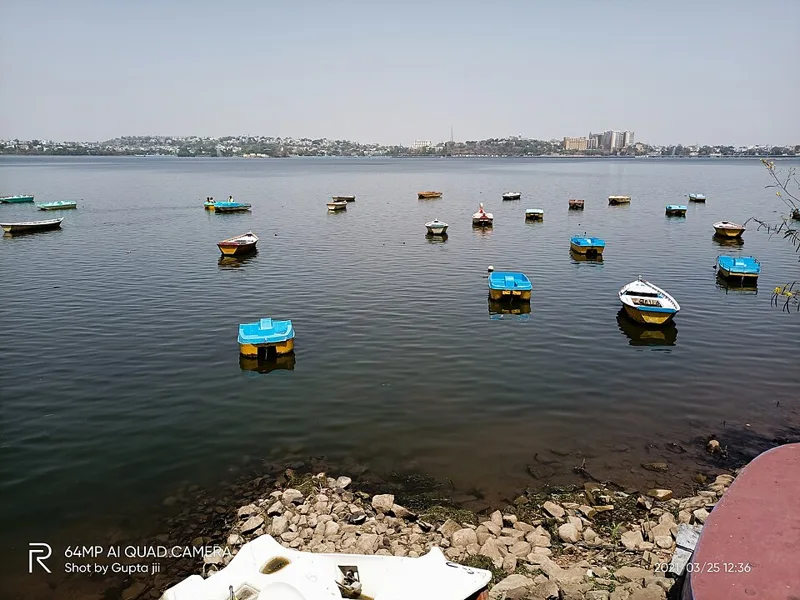
It was constructed by the legendary Paramara King Raja Bhoj in the 11th century.
Asked in SSC CGL 2024
Practice (1)
Q200Which of the following is the largest artificial lake of Asia?
Show answer
Correct answer: C — Bhopal Lake
Answer: (C)
Bhojtal (Upper Lake, Bhopal), built by Raja Bhoj, is called Asia’s largest artificial lake.