
🌍 Geography भूगोल
1178 exam-ready facts · 1109 MCQs
-
981
Bhojtal, also known as the Upper Lake in Bhopal, is historically acclaimed as the largest artificial lake in Asia.
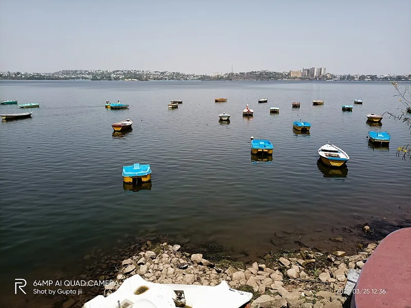
It was constructed by the legendary Paramara King Raja Bhoj in the 11th century.
Asked in SSC CGL 2024
Practice (1)
Q912Which of the following is the largest artificial lake of Asia?
Show answer
Correct answer: C — Bhopal Lake
Answer: (C)
Bhojtal (Upper Lake, Bhopal), built by Raja Bhoj, is called Asia’s largest artificial lake. -
982
The High Yielding Varieties Programme (HYVP) was launched in 1966-67 to boost agricultural production in India and initially covered about 2 million hectares of land.
It marked a major shift towards modern agricultural inputs in Indian farming.
Asked in SSC CGL 2022
Practice (1)
Q913In India initially HYVP was implemented in about how much area?
Show answer
Correct answer: D — 2 million hectares
Answer: (D)
The High Yielding Varieties Programme (1966-67) initially covered about 1.89 (≈2) million hectares. -
983
The Shevaroy Hills, located near Yercaud in Tamil Nadu, form an integral part of the Eastern Ghats.
The Eastern Ghats are a discontinuous range of mountains along India's eastern coast.
Asked in SSC CGL 2024 (12 Sep, Shift 2)
Practice (1)
Q914Which of the following hills is located in the Eastern Ghats?
Show answer
Correct answer: A — Shevaroy hills
Answer: (A)
The Shevaroy hills (Yercaud, Tamil Nadu) are part of the Eastern Ghats. Khasi and Naga hills are in the north-east; Anamudi is in the Western Ghats. -
984
Water vapour is the most abundant greenhouse gas in Earth's atmosphere, playing a critical role in the natural greenhouse effect and global climate regulation.
It accounts for the majority of the natural greenhouse warming of the planet.
Asked in SSC CGL 2022
Practice (1)
Q915Which of the following greenhouse gases is most abundant in the atmosphere?
Show answer
Correct answer: B — Water Vapour
Answer: (B)
Water vapour is the most abundant greenhouse gas in the atmosphere. -
985
Khadins are traditional agricultural runoff-harvesting structures uniquely designed and used in Jaisalmer, Rajasthan.
This system allows water to saturate the soil before cultivation of crops.
Asked in SSC CGL 2024 (12 Sep, Shift 3)
Practice (1)
Q916Identify a water-harvesting system found in Jaisalmer.
Show answer
Correct answer: C — Khadins
Answer: (C)
Khadins are runoff-farming structures of Jaisalmer, Rajasthan. -
986
The troposphere is the lowest layer of Earth's atmosphere, having an average height of about 13 km, varying from 8 km at the poles to 18 km at the equator.
Almost all weather phenomena occur within this lowest layer of the atmosphere.
Asked in SSC CGL 2022
Practice (1)
Q917What is the average height of troposphere?
Show answer
Correct answer: B — 13 km
Answer: (B)
The troposphere is about 13 km high on average (about 8 km at the poles and 18 km at the equator). -
987
The Brahmaputra River marks the eastern-most natural boundary and gorge section of the Himalayan mountain range.
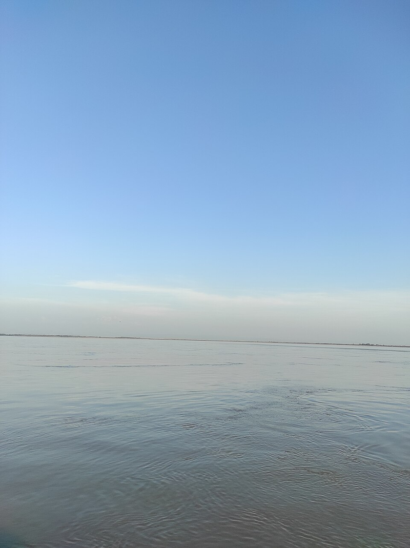
The Indus River marks the western-most boundary of the Himalayas.
Asked in SSC CGL 2024
Practice (1)
Q918Which of the following rivers marks the eastern-most boundary of the Himalayas?
Show answer
Correct answer: D — Brahmaputra
Answer: (D)
The Himalayas run from the Indus in the west to the Brahmaputra in the east. -
988
Exfoliation, often referred to as onion-peel weathering, is a type of physical weathering caused by thermal expansion.
Repeated heating and cooling causes the outer rock layers to peel off.
Asked in SSC CGL 2024 (13 Sep, Shift 2)
Practice (1)
Q919Exfoliation is a form of _________.
Show answer
Correct answer: C — physical weathering
Answer: (C)
Exfoliation (onion-peel weathering) comes from repeated heating and cooling, which makes it physical weathering. -
989
Ahmedabad is widely known as the 'Manchester of India' due to its prominent role as a major textile and cotton mill hub in the country.
It has historically been a major center for the Indian textile industry.
Asked in SSC CGL 2022
Practice (1)
Q920Which city is called the ‘Manchester of India’?
Show answer
Correct answer: D — Ahmedabad
Answer: (D)
Ahmedabad is called the "Manchester of India" for its textile mills. -
990
The Gulf of Mannar is a shallow bay located between the south-eastern tip of India and the western coast of Sri Lanka.
It is famous for its rich marine biodiversity and pearl fishery.
Asked in SSC CGL 2024 (13 Sep, Shift 3)
Practice (1)
Q921Where is the Gulf of Mannar located?
Show answer
Correct answer: D — Between the south-eastern tip of India and the western coast of Sri Lanka
Answer: (D)
The Gulf of Mannar lies between the south-eastern tip of India and the west coast of Sri Lanka. -
991
Moneylenders are informal and non-institutional sources of rural credit, operating outside the organized banking structure which includes commercial and regional rural banks.
Informal moneylenders often charge very high interest rates compared to institutional banks.
Asked in SSC CGL 2022
Practice (1)
Q922Which of the following is NOT a part of the institutional structure of rural banking?
Show answer
Correct answer: A — Moneylenders
Answer: (A)
Moneylenders are informal (non-institutional) sources of rural credit. -
992
Rice is a major tropical crop that requires high temperatures above 25°C, high humidity, and abundant annual rainfall for optimal growth.
It is a staple food crop for more than half of the world's population.
Asked in SSC CGL 2022
Practice (1)
Q923Which of the following major Indian crops requires high temperature (above 25°C) and high humidity?
Show answer
Correct answer: C — Rice
Answer: (C)
Rice needs a high temperature (above 25°C), high humidity and plenty of rainfall. -
993
Majuli, situated on the Brahmaputra River in Assam, is recognized as the largest inhabited riverine island in the world.
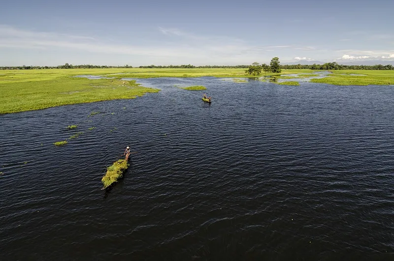
It has a unique cultural heritage tied to the Neo-Vaishnavite satras.
Asked in SSC CGL 2024
Practice (1)
Q924Which of the following is the largest inhabited riverine island in the world?
Show answer
Correct answer: C — Majuli
Answer: (C)
Majuli (Assam) is the largest inhabited river island. -
994
New Moore Island, also known as South Talpatti, was an island situated in geographical proximity to Bangladesh in the Bay of Bengal.
The island was eventually submerged due to rising sea levels.
Asked in SSC CGL 2024
Practice (1)
Q925The New Moore Island is in geographic proximity to:
Show answer
Correct answer: A — Bangladesh
Answer: (A)
New Moore (South Talpatti) Island lies near Bangladesh in the Bay of Bengal. -
995
Barley is a major Rabi crop in North India, sown during the winter season, whereas crops like rice, jowar, and maize belong to the Kharif season.
Rabi crops are typically sown in winter and harvested in spring.
Asked in SSC CGL 2022
Practice (1)
Q926Which among the following crops is related to the “Rabi” season in North India?
Show answer
Correct answer: D — Barley
Answer: (D)
Barley is a rabi crop sown in winter. Rice, jowar and maize are kharif crops. -
996
Mawsynram, which receives the highest average annual rainfall in the world, is located in the southern ranges of the Khasi Hills.
The funnel-shaped relief of the Khasi hills traps moisture-laden monsoon winds.
Asked in SSC CGL 2024 (25 Sep, Shift 3)
Practice (1)
Q927In the southern ranges of which hills is Mawsynram, which receives the highest rainfall in the world, located?
Show answer
Correct answer: C — Khasi hills
Answer: (C)
Mawsynram lies in the Khasi Hills of Meghalaya. -
997
Mango showers are pre-monsoon thunderstorms common in Kerala and coastal Karnataka that help in the early ripening of mangoes.
These local winds are also beneficial for tea and coffee plantations in South India.
Asked in SSC CGL 2022
Practice (1)
Q928Mango showers are common in ______________.
Show answer
Correct answer: B — Kerala
Answer: (B)
Mango showers are pre-monsoon showers in Kerala and coastal Karnataka that help mangoes ripen. -
998
During the first phase of the Green Revolution in India, high-yielding variety (HYV) seeds were primarily introduced in agriculturally progressive states like Punjab, Tamil Nadu, and Andhra Pradesh.
This initial phase heavily focused on regions with assured irrigation facilities.
Asked in SSC CGL 2022
Practice (1)
Q929In the first phase of the green revolution, the use of HYV seeds was restricted to the more affluent of which group of states?
Show answer
Correct answer: C — Punjab, Tamil Nadu and Andhra Pradesh
Answer: (C)
In the first phase of the Green Revolution, HYV seeds were used mainly in Punjab, Haryana, western UP, Andhra Pradesh and Tamil Nadu. Of the options, Punjab, Tamil Nadu and Andhra Pradesh fit. -
999
Hanging valleys often occur at elevations along main glacial valleys, and their spurs are frequently truncated into triangular facets.
Glacial erosion creates hanging valleys that drop steeply into the main valley floor.
Asked in SSC CGL 2025 (12 Sep, Shift 1)
Practice (1)
Q930Consider the following statements about glacial landforms:<br>Statement 1: Hanging valleys are often found opening into main glacial valleys at higher elevations.<br>Statement 2: Spurs of such hanging valleys are frequently truncated into triangular facets.<br>Which of the following Statements is/are Correct?
Show answer
Correct answer: C — 1 and 2 are correct
Answer: (C)Both statements come almost word for word from NCERT's Class XI Fundamentals of Physical Geography.
It says there can be hanging valleys at an elevation on one or both sides of the main glacial valley. It adds that the spurs of such hanging valleys opening into the main valley are quite often truncated into triangular facets.
So statements 1 and 2 are both correct.
Why the others are wrong(a)Only 1: It drops a true statement. NCERT itself says the spurs of hanging valleys opening into the main valley are quite often truncated into triangular facets.(b)Only 2: It drops the statement NCERT puts first: hanging valleys sit at an elevation on one or both sides of the main glacial valley.(d)Neither 1 nor 2 are correct: Both lines restate NCERT's description of glacial troughs, so rejecting both means rejecting the textbook's own account of a glaciated valley. -
1000
A slump is a type of landslide characterized by the backward rotation of slipping rock debris along a slope.
Slumping involves rotational movement along a curved failure surface.
Asked in SSC CGL 2025 (12 Sep, Shift 2)
Practice (1)
Q931Which of the following types of landslides involves backward rotation of the slipping material?
Show answer
Correct answer: C — Slump
Answer: (C)NCERT's Class XI Fundamentals of Physical Geography defines slump as the slipping of one or several units of rock debris with a backward rotation with respect to the slope over which the movement takes place.
It sets slump against debris slide, the rapid rolling or sliding of earth debris without that rotation → option (c).
Why the others are wrong(a)Rockslide: A rockslide is individual rock masses sliding down bedding, joint or fault surfaces. NCERT's definition carries no backward rotation.(b)Rock fall: Rock fall is the free fall of rock blocks over a steep slope, keeping away from the slope. The rock falls clear, so nothing slips or rotates.(d)Debris fall: Debris fall is a nearly free fall of earth debris from a vertical or overhanging face. It drops rather than slipping along the slope.