
🌍 Geography भूगोल
1178 exam-ready facts · 1109 MCQs
-
401
Venus is the second planet from the Sun, positioned directly between Mercury and Earth.
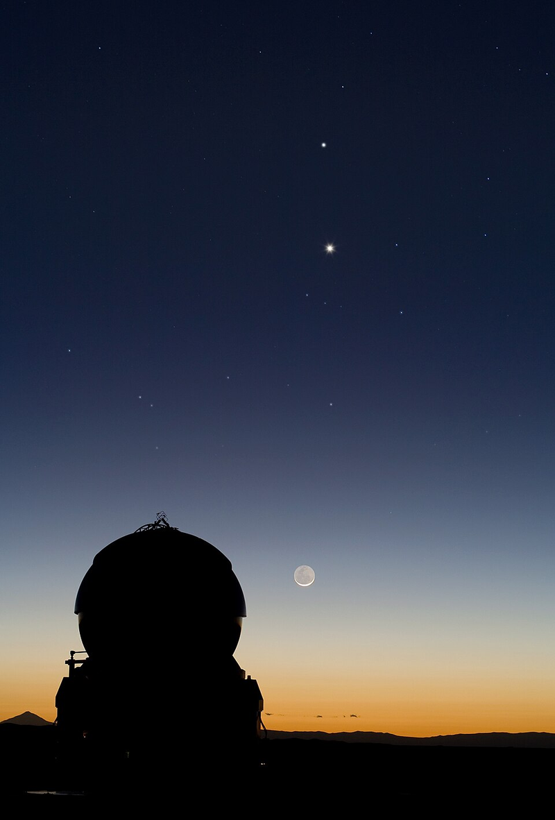
Venus is often called Earth's twin due to its similar size and mass.
Asked in SSC CGL 2019
Practice (1)
Q400In the sequence of planets in the Solar system, which planet comes in between Mercury and Earth?
Show answer
Correct answer: B — Venus
Answer: (B)
The order is Mercury, Venus, Earth: Venus lies between them. -
402
The Sri Padmanabhaswamy Temple is located in Thiruvananthapuram, India, not in Sri Lanka.
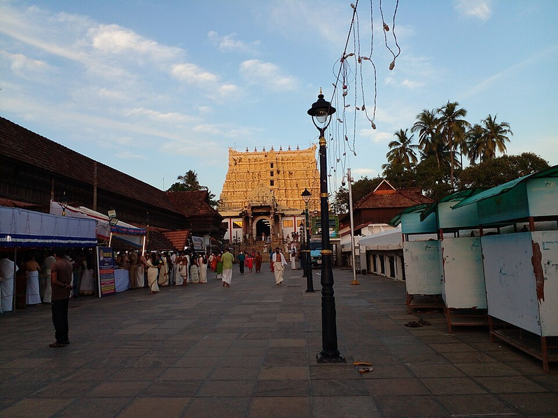
It is famous for its intricate architecture and massive temple treasures.
Asked in SSC CGL 2017
Practice (1)
Q401Which of the following country doesn't matches to its famous tourist place?
Show answer
Correct answer: D — Sri Lanka – Padmanabhaswamy Temple
Answer: (D)
The Padmanabhaswamy Temple is in Thiruvananthapuram, India, not Sri Lanka. -
403
The Tapti (Tapi) river empties into the Gulf of Cambay (Khambhat) of the Arabian Sea in Gujarat.
It is one of the major west-flowing rivers of peninsular India.
Asked in SSC CGL 2021 (20 Aug, Shift 1)
Practice (1)
Q402Which of the following rivers empties into the Gulf of Cambay of the Arabian Sea, in the state of Gujarat?
Show answer
Correct answer: C — Tapti
Answer: (C)
The Tapti (Tapi) flows west into the Gulf of Khambhat (Cambay). -
404
The primary goal of the Chabahar port project is to boost regional trade by providing an alternative trade route.
Located in Iran, Chabahar provides India a strategic trade route bypassing Pakistan to reach Afghanistan and Central Asia.
Asked in SSC CGL 2025 (21 Sep, Shift 1)
Practice (1)
Q403Which of the following is a main goal of the Chabahar port project?
Show answer
Correct answer: D — To boost regional trade
Answer: (D)Chabahar is an Iranian port on the Gulf of Oman, in Sistan and Baluchestan province, where India took over operations at the Shahid Beheshti terminal in December 2018.
The project is commercial. It gives Indian cargo a sea-and-land route to Afghanistan and Central Asia that avoids Pakistan, which is regional trade → option (d).
Why the others are wrong(a)To increase military presence in the region: Military presence is not the project's aim. India's role has been commercial: India Ports Global Limited took over a cargo terminal there, and the project is a transit route for trade.(b)To mine for undersea minerals: Undersea minerals play no part. Chabahar is a cargo port on the Gulf of Oman, and the project is about moving goods, not extracting anything from the seabed.(c)To increase tourism in Iran: Tourism is not the goal. The investment is in berths, cargo handling and a transit route to Afghanistan and Central Asia, which serve traders rather than visitors. -
405
Water vapour is consistently the most abundant gas released during volcanic eruptions worldwide.
Volcanic gases also include significant amounts of carbon dioxide and sulfur dioxide.
Asked in SSC CGL 2020 (6 Mar, Shift 1)
Practice (1)
Q404Which of the following gases is consistently seen to be most abundant in a volcanic eruption?
Show answer
Correct answer: A — Water vapour
Answer: (A)
Water vapour is the most abundant volcanic gas, followed by CO₂ and SO₂. -
406
Gorumara National Park is situated in the Dooars region of the Jalpaiguri district in northern West Bengal, famous for the great Indian one-horned rhinoceros.
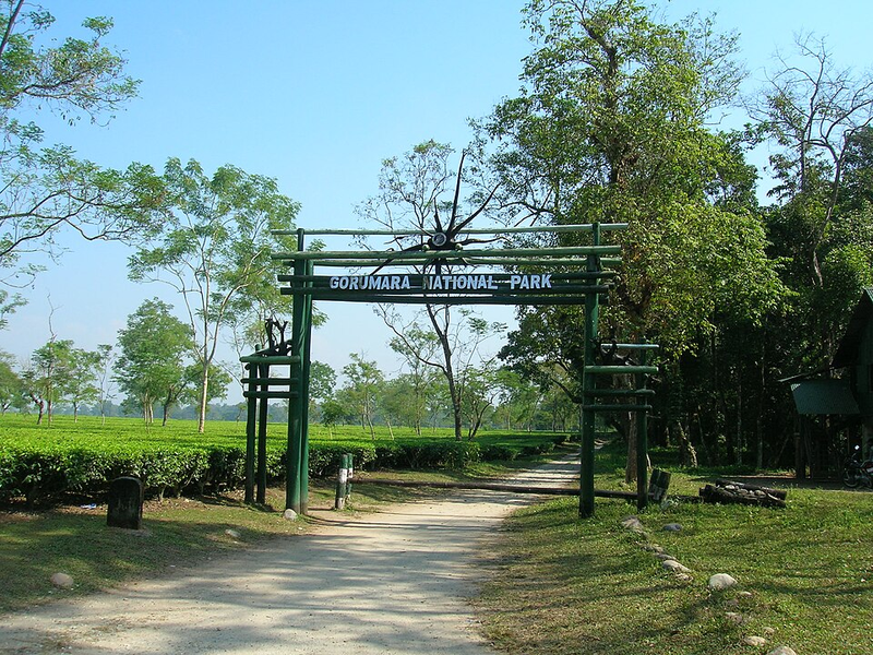
Gorumara was declared a wildlife sanctuary in 1949 and designated as a national park in 1994.
Asked in SSC CGL 2023
Practice (1)
Q405In which state is the Gorumara National Park located?
Show answer
Correct answer: B — West Bengal
Answer: (B)Gorumara National Park is situated in the Dooars region of the Jalpaiguri district in northern West Bengal, on the floodplains of the Murti and Raidak rivers. It was declared a wildlife sanctuary in 1949 and designated as a national park in 1994, primarily recognized for its population of the great Indian one-horned rhinoceros (Rhinoceros unicornis).
Hence, the correct option is (2).
-
407
The first non-synchronous Census of India was conducted in 1872 under British rule.
The first synchronous census covering the entire country uniformly took place in 1881.
Asked in SSC CGL 2022
Practice (1)
Q406In India the 1st census was held in the year ______.
Show answer
Correct answer: A — 1872
Answer: (A)
The first (non-synchronous) census of India was taken in 1872. The first synchronous census was in 1881. -
408
SIDO (Small Industries Development Organisation) is an apex body for formulation of policies and programmes for the development of small scale industries in India.
It functions under the Ministry of Micro, Small and Medium Enterprises.
Asked in SSC CGL 2016 (4 Sep, Shift 2)
Practice (1)
Q407SIDO is related to the development of
Show answer
Correct answer: A — Small industries
Answer: (A)
The correct option is (A). -
409
Saddle Peak, located in North Andaman, is the highest point in the Andaman and Nicobar Islands at 732 metres.
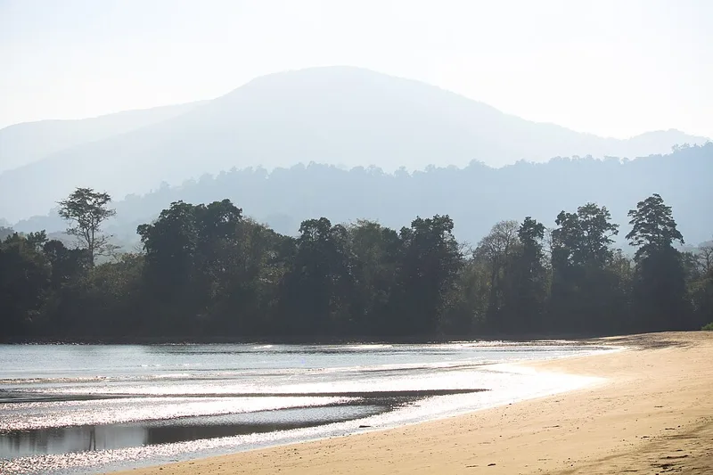
It is situated within the Saddle Peak National Park.
Asked in SSC CGL 2017
Practice (1)
Q408Which is the highest peak in Andaman and Nicobar islands?
Show answer
Correct answer: C — Saddle Peak
Answer: (C)
Saddle Peak (732 m) in North Andaman is the highest peak of the islands. -
410
Wheat, rice, and maize are the three major cereal crops that contribute the maximum to global food grain production.
These three crops together feed a major portion of the global population daily.
Asked in SSC CGL 2016 (6 Sep, Shift 2)
Practice (1)
Q409Three crops that contribute maximum to global food grain production are _________
Show answer
Correct answer: D — wheat, rice, maize
Answer: (D)
The correct option is (D). -
411
China holds observer status and is not a member country of SAARC.
SAARC comprises eight nations primarily in South Asia.
Asked in SSC CGL 2017 (10 Aug, Shift 3)
Practice (1)
Q410Which of the following country is not a member of SAARC?
Show answer
Correct answer: C — China
Answer: (C)
China is an observer, not a member, of SAARC. -
412
Earth completes one full 360-degree rotation on its axis approximately every 24 hours, translating to 15 degrees per hour.
This rotation rate is responsible for the cycle of day and night across the globe.
Asked in SSC CGL 2020 (6 Mar, Shift 2)
Practice (1)
Q411How many degrees does the Earth rotate about its own axis in one hour?
Show answer
Correct answer: A — 15
Answer: (A)
360° in 24 h = 15° per hour. -
413
The Brahmaputra river originates from the Chemayungdung glacier of the Kailash range near Mansarovar.
In Tibet, its upper stream is known as the Yarlung Tsangpo.
Asked in SSC CGL 2021 (17 Aug, Shift 2)
Practice (1)
Q412Where does the river Brahmaputra originate?
Show answer
Correct answer: A — Chemayungdung glacier of the Kailash range
Answer: (A)
The Brahmaputra (Yarlung Tsangpo) rises from the Chemayungdung glacier of the Kailash range near Mansarovar. -
414
Plant varieties like bamboo, epiphytes, aini, semul, gutel, and mundane are found in moist tropical forests in India.
Moist tropical forests support a dense and diverse canopy structure with various plant species.
Asked in SSC CGL 2023 (24 Jul, Shift 2)
Practice (1)
Q413Plant varieties like bamboo, epiphytes, aini, semul, gutel and mundane are found in which type of Indian forest?
Show answer
Correct answer: C — Moist tropical forest
Answer: (C)
Bamboo, epiphytes, aini, semul and gurjan are found in moist tropical forests. -
415
Pradhan Mantri Gram Sadak Yojana (PMGSY) focuses on improving road infrastructure in rural areas of India.
Launched on 25 December 2000, PMGSY aims to provide all-weather road connectivity to unconnected rural habitations.
Asked in SSC CGL 2025 (21 Sep, Shift 1)
Practice (1)
Q414Which government initiative focuses on improving the road infrastructure in rural areas of India?
Show answer
Correct answer: B — Pradhan Mantri Gram Sadak Yojana (PMGSY)
Answer: (B)The Pradhan Mantri Gram Sadak Yojana (PMGSY) was launched on 25 December 2000 under the Ministry of Rural Development.
Its aim is all-weather road connectivity for unconnected villages, the rural-road focus the stem describes → option (b).
Why the others are wrong(a)Bharatmala Pariyojana: Bharatmala Pariyojana is a national-highway programme of the Ministry of Road Transport and Highways, built around economic corridors, feeder routes and border and coastal roads, not village roads.(c)National Highways Development Project (NHDP): The NHDP, launched in 1998, upgraded national highways such as the Golden Quadrilateral. Bharatmala later subsumed it, and neither was a rural-road scheme.(d)Setu Bharatam Programme: Setu Bharatam, launched on 4 March 2016, builds railway over- and under-bridges to free national highways of level crossings. It is a highway-safety scheme, not a rural one. -
416
Myanmar is not a landlocked country as it has a coastline opening into the Bay of Bengal and the Andaman Sea.
Countries like Nepal, Bhutan, and Afghanistan are entirely surrounded by land with no direct ocean access.
Asked in SSC CGL 2017 (12 Aug, Shift 3)
Practice (1)
Q415Which of the following neighbouring country of India is not a landlocked country?
Show answer
Correct answer: B — Myanmar
Answer: (B)
Myanmar has a coastline; Nepal, Bhutan and Afghanistan are landlocked. -
417
The male literacy rate in India reached 82.14 percent according to the 2011 Census.
Female literacy stood at 65.46 percent, bringing the national average to 74.04 percent.
Asked in SSC CGL 2022
Practice (1)
Q416According to census 2011, the male literacy rate in India is ______.
Show answer
Correct answer: B — 82.14 percent
Answer: (B)
Census 2011: male literacy 82.14%, female 65.46%, overall 74.04%. -
418
The census in India is conducted regularly every 10 years.
It is one of the largest administrative and statistical exercises in the world.
Asked in SSC CGL 2022
Practice (1)
Q417In India census is held regularly every ______ year.
Show answer
Correct answer: B — 10th
Answer: (B)
India’s census is held every 10 years. -
419
Trading, commerce, and transport are classified as tertiary economic activities involving the commercial output of services.
Primary activities involve resource extraction, while secondary activities deal with manufacturing.
Asked in SSC CGL 2016 (6 Sep, Shift 2)
Practice (1)
Q418Which of the following is a tertiary activity?
Show answer
Correct answer: D — Trading
Answer: (D)
The correct option is (D). -
420
The crust is the outermost solid layer of the Earth, accounting for less than 1 percent of Earth's total mass.
It forms the upper part of the lithosphere and supports all terrestrial life.
Asked in SSC CGL 2020 (7 Mar, Shift 3)
Practice (1)
Q419Which of the following is the outermost solid part of the Earth?
Show answer
Correct answer: B — Crust
Answer: (B)
The crust is the outermost solid layer of the Earth.