
🗺️ India: Physical Features भारत: भौतिक स्वरूप
227 exam-ready facts · 227 MCQs
-
61
The Himalayan mountain range is classified as a young fold mountain system formed by tectonic plate collision.
It formed due to the convergence of the Indian Plate and the Eurasian Plate.
Asked in SSC CGL 2017 (11 Aug, Shift 1)
Practice (1)
Q61Himalayan mountain range falls under which type of mountains?
Show answer
Correct answer: D — Fold Mountain
Answer: (D)
The Himalayas are young fold mountains. -
62
Five Indian states share their international land boundaries with Nepal.
These states are Uttarakhand, Uttar Pradesh, Bihar, West Bengal, and Sikkim.
Asked in SSC CGL 2017 (12 Aug, Shift 2)
Practice (1)
Q62How many Indian states share their boundaries with Nepal?
Show answer
Correct answer: D — 5
Answer: (D)
Uttarakhand, UP, Bihar, West Bengal and Sikkim border Nepal, which makes 5 states. -
63
Saddle Peak, located in North Andaman, is the highest point in the Andaman and Nicobar Islands at 732 metres.
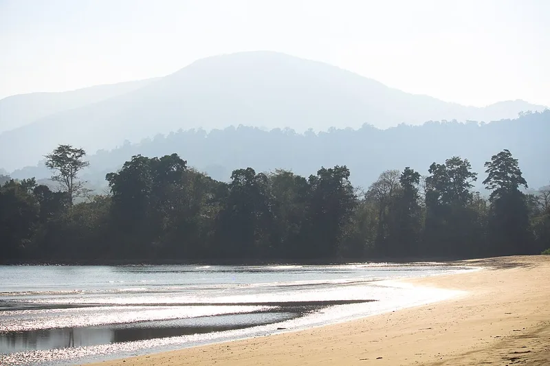
It is situated within the Saddle Peak National Park.
Asked in SSC CGL 2017
Practice (1)
Q63Which is the highest peak in Andaman and Nicobar islands?
Show answer
Correct answer: C — Saddle Peak
Answer: (C)
Saddle Peak (732 m) in North Andaman is the highest peak of the islands. -
64
Myanmar is not a landlocked country as it has a coastline opening into the Bay of Bengal and the Andaman Sea.
Countries like Nepal, Bhutan, and Afghanistan are entirely surrounded by land with no direct ocean access.
Asked in SSC CGL 2017 (12 Aug, Shift 3)
Practice (1)
Q64Which of the following neighbouring country of India is not a landlocked country?
Show answer
Correct answer: B — Myanmar
Answer: (B)
Myanmar has a coastline; Nepal, Bhutan and Afghanistan are landlocked. -
65
India shares its land boundaries with Pakistan situated to its north-west.
The border between India and Pakistan in this sector includes the Radcliffe Line.
Asked in SSC CGL 2017 (17 Aug, Shift 1)
Practice (1)
Q65In the north-west, India shares its land boundaries with which<br>country?
Show answer
Correct answer: D — Pakistan
Answer: (D)
India's north-western land neighbour is Pakistan. -
66
The section of the Himalayas lying between the Satluj and Kali rivers is officially designated as the Kumaon Himalayas.
This region falls largely within the state of Uttarakhand.
Asked in SSC CGL 2017 (17 Aug, Shift 1)
Practice (1)
Q66The part of the Himalayas lying between Satluj and Kali rivers<br>is known as ____________.
Show answer
Correct answer: C — Kumaon Himalayas
Answer: (C)
The Himalaya between the Satluj and the Kali is the Kumaon Himalaya. -
67
India possesses a total land boundary of approximately 15,200 kilometres.
This extensive boundary touches several neighboring countries in South and East Asia.
Asked in SSC CGL 2017 (17 Aug, Shift 3)
Practice (1)
Q67India has a land boundary of about _________ km.
Show answer
Correct answer: C — 15200
Answer: (C)
India's land boundary is about 15,200 km. -
68
The Patkai hills are situated along India's eastern border with Myanmar and form a part of the Purvanchal mountain ranges.
They are composed of strong sandstone and created by tectonic activity during the Tertiary period.
Asked in SSC CGL 2017 (17 Aug, Shift 3)
Practice (1)
Q68The Patkai hills belong to which mountain ranges?
Show answer
Correct answer: B — Purvanchal
Answer: (B)
The Patkai hills are part of the Purvanchal (eastern hills). -
69
The part of the Himalayas lying between the Tista and Dihang rivers is known as the Assam Himalayas.
This eastern section spans parts of Arunachal Pradesh, Assam, and neighboring Bhutan.
Asked in SSC CGL 2017 (18 Aug, Shift 1)
Practice (1)
Q69The part of the Himalayas between Tista and Dihang rivers is<br>known as _________ Himalayas.
Show answer
Correct answer: C — Assam
Answer: (C)
The Himalaya between the Tista and Dihang is the Assam Himalaya. -
70
Beyond the Dihang gorge, the Himalayas bend sharply to the south and spread along the eastern boundary of India.
The Dihang gorge marks the eastern-most tectonic boundary of the Himalayan mountain range.
Asked in SSC CGL 2017 (18 Aug, Shift 3)
Practice (1)
Q70Beyond the _____________, the Himalayas bend sharply to the<br>south and spread along the eastern boundary of India.
Show answer
Correct answer: B — Dihang gorge
Answer: (B)
Beyond the Dihang gorge the Himalayas bend south along India's eastern border. -
71
The National Highway 1A connects Leh to Kashmir Valley through the Zoji La pass.
Zoji La is a high mountain pass in Ladakh located on the Srinagar-Leh highway.
Asked in SSC CGL 2017 (18 Aug, Shift 3)
Practice (1)
Q71The National Highway 1A connects Leh to Kashmir Valley through<br>the ___________ pass.
Show answer
Correct answer: B — Zoji la
Answer: (B)
NH 1A links Leh and the Kashmir Valley through Zoji La. -
72
The northern plain of India is formed of alluvial soil deposited by major river systems.
Alluvial soil in the Indo-Gangetic plains is extremely fertile and supports intense agriculture.
Asked in SSC CGL 2017 (18 Aug, Shift 2)
Practice (1)
Q72The northern plain of India is formed of __________________.
Show answer
Correct answer: C — alluvial soil
Answer: (C)
The northern plain is made of alluvial soil. -
73
India had 29 states as of June 2017 before the reorganization of Jammu and Kashmir.
Telangana was formed as the 29th state of India in June 2014.
Asked in SSC CGL 2017 (17 Aug, Shift 2)
Practice (1)
Q73How many states does<br>India have as of June 2017?
Show answer
Correct answer: D — 29
Answer: (D)
In June 2017 India had 29 states. -
74
India is the 7th largest country in the world by total geographical area.
Russia is the largest country in the world by area, covering over 17 million square kilometers.
Asked in SSC CGL 2017 (19 Aug, Shift 1)
Practice (1)
Q74India is the ______ largest country in the world.
Show answer
Correct answer: C — 7th
Answer: (C)
India is the 7th largest country by area. -
75
Bihar does not share its international border with China, whereas Himachal Pradesh and Sikkim do.
Bihar shares its international border only with the country of Nepal to its north.
Asked in SSC CGL 2017 (19 Aug, Shift 1)
Practice (1)
Q75China does not share its border with which Indian state?
Show answer
Correct answer: A — Bihar
Answer: (A)
Bihar does not border China. -
76
In due course of time, a meander loop cuts off from the river and forms an ox-bow lake.
Ox-bow lakes are commonly found along the mature stages of meandering rivers in flat plains.
Asked in SSC CGL 2017 (19 Aug, Shift 2)
Practice (1)
Q76In due course of time the meander loop cuts off from the river<br>and forms a cut-off lake, also called an _________ lake.
Show answer
Correct answer: A — ox-bow
Answer: (A)
A cut-off meander forms an ox-bow lake. -
77
Sir Creek is a 96-kilometer tidal estuary on the border of India and Pakistan in the Rann of Kutch.
Sir Creek opens into the Arabian Sea and is a disputed water body between India and Pakistan.
Asked in SSC CGL 2017 (19 Aug, Shift 2)
Practice (1)
Q77Name the estuary on the border of India and Pakistan?
Show answer
Correct answer: B — Sir Creek
Answer: (B)
Sir Creek is the disputed estuary on the India-Pakistan border in the Rann of Kutch. -
78
As a river enters the plain, it twists and turns forming large bends known as meanders.
Meanders form due to the continuous erosion of the outer bank and deposition on the inner bank of a river.
Asked in SSC CGL 2017 (19 Aug, Shift 3)
Practice (1)
Q78As the river enters the plain it twists and turns forming<br>large bends known as ____________.
Show answer
Correct answer: D — meanders
Answer: (D)
Large bends of a river in the plains are meanders. -
79
Granite is a classic example of an intrusive igneous rock formed by slow cooling of magma.
Intrusive igneous rocks have large mineral crystals because they cool slowly beneath the Earth's surface.
Asked in SSC CGL 2017 (20 Aug, Shift 1)
Practice (1)
Q79_________ is an example of intrusive igneous rock.
Show answer
Correct answer: D — Granite
Answer: (D)
Granite forms when magma cools slowly deep inside the Earth, so it is an intrusive igneous rock. -
80
The longitudinal valleys lying between the Lesser Himalaya and the Shiwaliks are known as Duns.
Dehradun, Patli Dun, and Kotli Dun are famous examples of these longitudinal valleys.
Asked in SSC CGL 2017 (20 Aug, Shift 1)
Practice (1)
Q80The longitudinal valley lying between lesser Himalaya and the ____________ are known as Duns.
Show answer
Correct answer: C — Shiwaliks
Answer: (C)
Duns are longitudinal valleys between the Lesser Himalaya (Himachal) and the Shiwaliks, for example Dehradun.